***
We passed the 1 year anniversary of living in the HMS Beangle on Sunday and it feels so natural by now that we didn’t even remember until well into yesterday afternoon. I want to say a very public and loud Thank You So Much to Joe & Chris for their support in letting us stay Coloradans and for keeping our mail coming this past year. Their help has truly been fundamental.
***
I first wrote the title as ‘Two Star Fort Ruins at Crown Point’ but realized how much it sounded like a disgruntled Yelp review. Fear not, our visit to New York’s Crown Point State Historic Park and National Historical Site was quite enjoyable. No need to speak to the manager. We arrived on a Monday, a day the museum is closed, so I’m only left wishing we’d been able to see the indoor exhibits, too. I read that they’re pretty good.
Grab those #2 pencils again. We’re going to start with the essentials of geography.
First: The St. Lawrence Seaway connects the Great Lakes to the Atlantic Ocean. And yes, one of those Great Lakes is named Lake Ontario — to insist on calling it anything else is simply acting like a petulant toddler desperately in need of a new diaper and a nap.
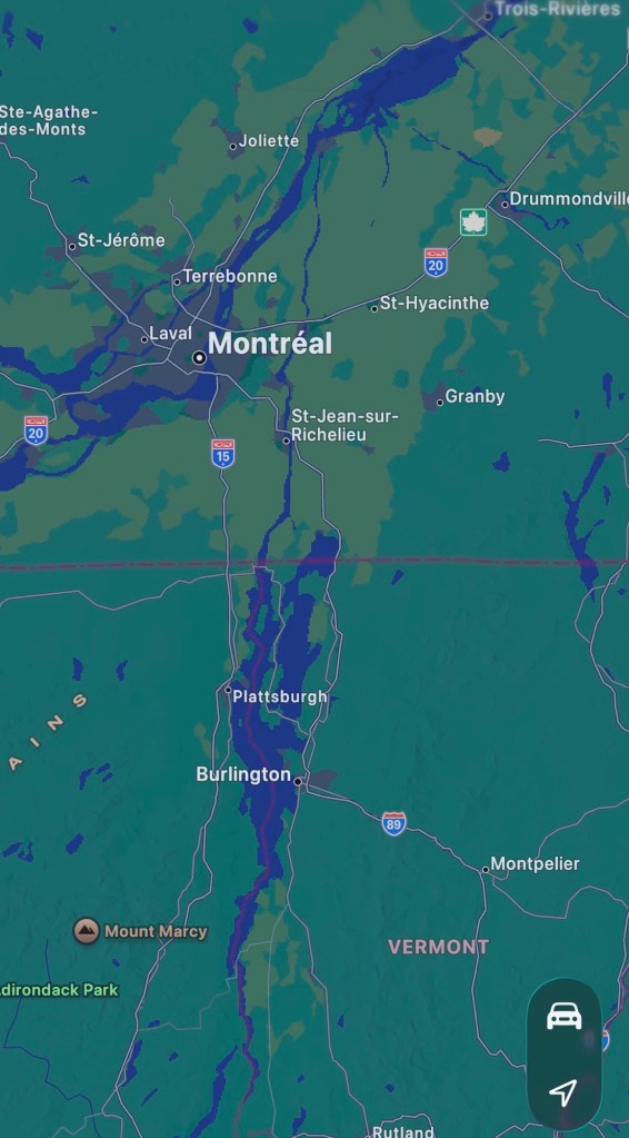
Second: Running straight south from the St. Lawrence River in Quebec, Rivière Richelieu (ooh la la) connects to Lake Champlain, Wood Creek, and then the Hudson River, ultimately draining into the Atlantic Ocean at New York City. Troops, food, trade goods, and all manner of supplies and information have slid through these waterways over millennia.
Third: The bend at Crown Point is a mere quarter of a mile wide, consolidating all the river’s traffic into one easy to oversee and control spot. With that in mind, it’s easy to understand why the French, British, and American governments all tried to control this strategic point—in times of peace and especially in times of war. There are a number of strategically located bends or narrows (also called straits) around the world that can exert an unusually vice-like grip on water-based transportation. Seems like that would be an important thing to remember.
Now, let’s get to the forts specifically.
In order to protect their trade and colonizing interests, the French first built a small, temporary wooden fort on the eastern (Vermont) side of the water in 1731 that housed about 30 men. Today it’s called Chimney Point. After the French completed the more robust Fort St. Frédéric on the western (New York) side in 1737, today called Crown Point, the temporary structure was deemed redundant and abandoned. I assume they dismantled it and reused the materials inside the new fort, but I can’t say for sure.
That’s a lot of back and forth, so for clarification, eastern side is older and western is newer.
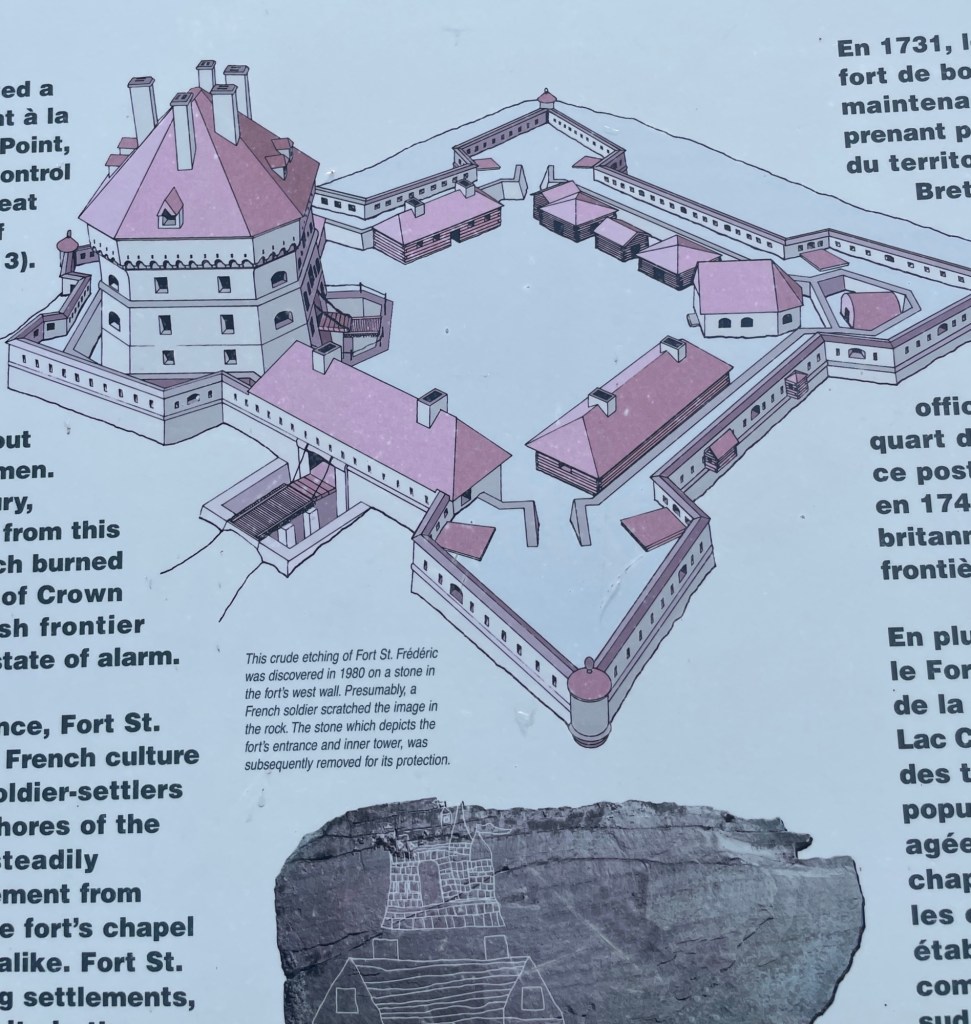
I’m pretty sure that anyone reading this is a resident of a relatively densely populated, modern-convenience-filled community with easy access to anything we need and anyone we want to communicate with. Sure, we might live in a rural town 30-45 minutes from anywhere. Maybe we don’t have cell service or internet access 24/7. Storms can keep us stuck at home a day or two at a time. But we live on roads. We have mailboxes. Groceries are only a drive away. And if we go to a higher elevation or drive a bit, we can get a signal. Not these men. They were effectively cut off from easy access to their countrymen and to the basics of sustenance.
I’ve tried and failed to imagine 30 men moving into a densely forested part of the American continent to live in a hastily built wooden box on the edge of a lake. What if they didn’t know each other, or worse actively disliked a couple of the others? Too bad, that didn’t matter. Their duty to King and Country was to build and maintain Fort St. Frédéric and wait for their most despised enemy to show up with little to no notice. No distractions. No say in how things were done. No privacy. I can be prickly; I don’t think it would be the job for me.
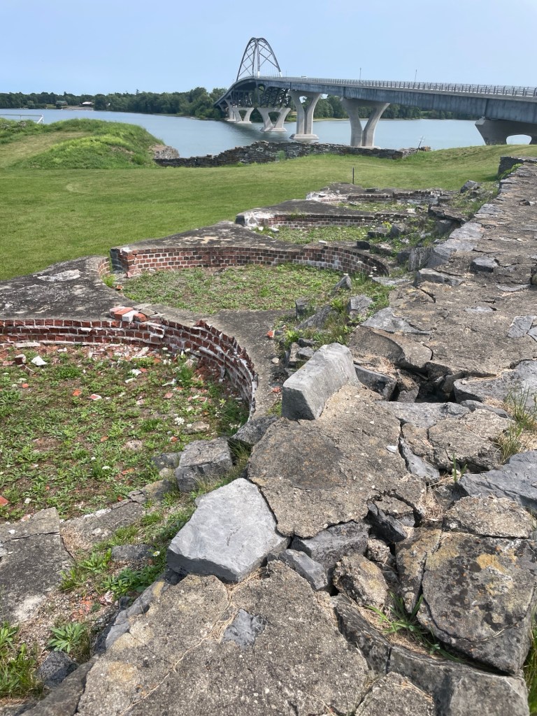
In wandering around the French fort ruins, the foundations of the beehive bread ovens took my breath away. Each one is about the size of the HMS Beangle! Imagine spinning a queen-size mattress in a circle and you’ll have a rough idea of each beehive oven’s size. Bread was the mainstay of a French soldier’s existence, supplemented by what they could hunt, gather, and with time grow, so a bakery was usually the first thing built. No bread, no fort. It was as simple as that. I imagine the walls lined with racks and racks of dough, but I don’t know how the bread ovens actually worked. And since the visitor center was closed, I couldn’t ask. Maybe I do need to speak to a manager, after all. Regardless, I continue to be intrigued by how they operated. That’s a rabbit hole for me to fall down some bad weather day. If I find out, I’ll try to remember to pass it on.
It should go without saying, but let’s say it anyways, the land that the French and British were settling on and traveling through was far from empty. It wasn’t a desolate or uninhabited land; it wasn’t a blank slate. Yes, population densities were likely significantly lower than the incoming soldiers were used to back in Europe, especially after a few rounds of smallpox and other imported diseases had raced through the native population. And yes, the ways that the indigenous people lived were different from the intensive farming and private property-based norms of Europe, but it was far from empty.
By the early 1700s, the French had intact relationships and trade arrangements with many of the Pitawbagw region’s indigenous tribes. (Pitawbagw means “the lake in between” and is the Abanaki name for what we now call Lake Champlain.) These tribes lived around and along either side of Pitawbagw. They were part of the easterly Algonquian-speaking Wabanaki Confederacy—such as the Abenaki and the Penacook—and their traditional adversary, the westerly Iroquoian-speaking tribes of the Haudenosaunee League—such as the Mohawk and the Oneida. Around this time, as settlements pushed ever westward, not only was the conflict between the French and British heating up, but so was the ongoing tension between the Wabanaki and Haudenosaunee. Despite their best efforts, the individual tribes were soon forced to pick sides.
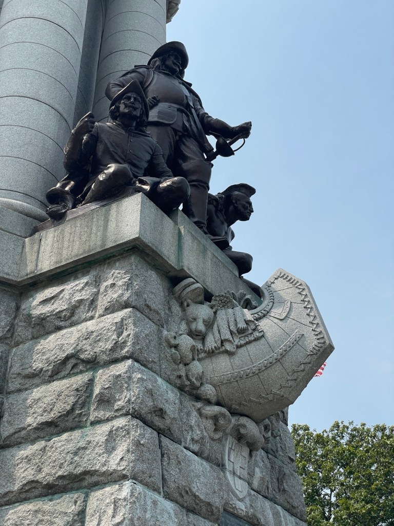
Soon after Fort St. Frédéric was up and running, King Louis XV of France granted a large swath of land on the opposite shore *insert a raised eyebrow here* to French citizens, to encourage them to settle the area—spreading out from the temporary fort’s location. In under 15 years, there were more than 20 homesteads within a few miles of the crossing between Chimney Point and Crown Point. But with the advancement of the British Army during the French and Indian Wars (1754-1763), the settlers eventually abandoned the region and fled north, back to French-held Quebec, when it was clear that Fort St. Frédéric would fall.
I can hardly imagine the grief of having poured myself and all my resources into building a homestead, far from everyone and everything I once knew, only to abandon it forever. While on a different scale and with different financial repercussions, seeing the grief of people impacted by the current wildfires, floods, and droughts this summer gives me a glimmer of the pain these settlers incurred. It’s different of course. We generally have insurance, community emergency services, and nearby cities/states to lend a hand, but such heart-crushing pain and the sense of hopelessness in times of disaster feels timeless and universal.
And then in 1759, the British did arrive.
They found a preemptively destroyed (a la, you-can’t-play-with-my-toys) Fort St. Fédéric and immediately began to build a fort of their own. Bigger and badder, just behind the ruins of the other one. I imagine it going down something like this: “You had four points? We’ll have five! You had high walls? We’ll have higher walls and extra deep ditches! You blew up your powder magazine? Well, we don’t know it yet, but we’ll accidentally do that too! Wait, what?!” But I’m getting ahead of myself there.
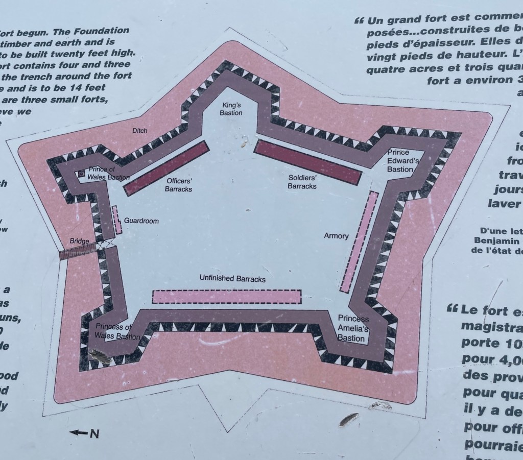
General Amherst employed up to 3,000 soldiers and artisans to work on the British fort, roads, outbuildings, gardens, etc. at Crown Point. Even with civilian and tradesmen’s homes and public services such as taverns, stores, laundresses, all outside the fort’s walls, it’s a small area. Imagining so many people there takes a bit of effort. But work on the fort pretty much stopped when France’s claim to Canada was ceded to the British at the end of the French and Indian War in 1863. It doesn’t appear that the local tribes got a say in the matter. Shocker, I know. Inside the mostly complete fort, a barrack was left unbuilt as the anticipated troops were no longer needed.
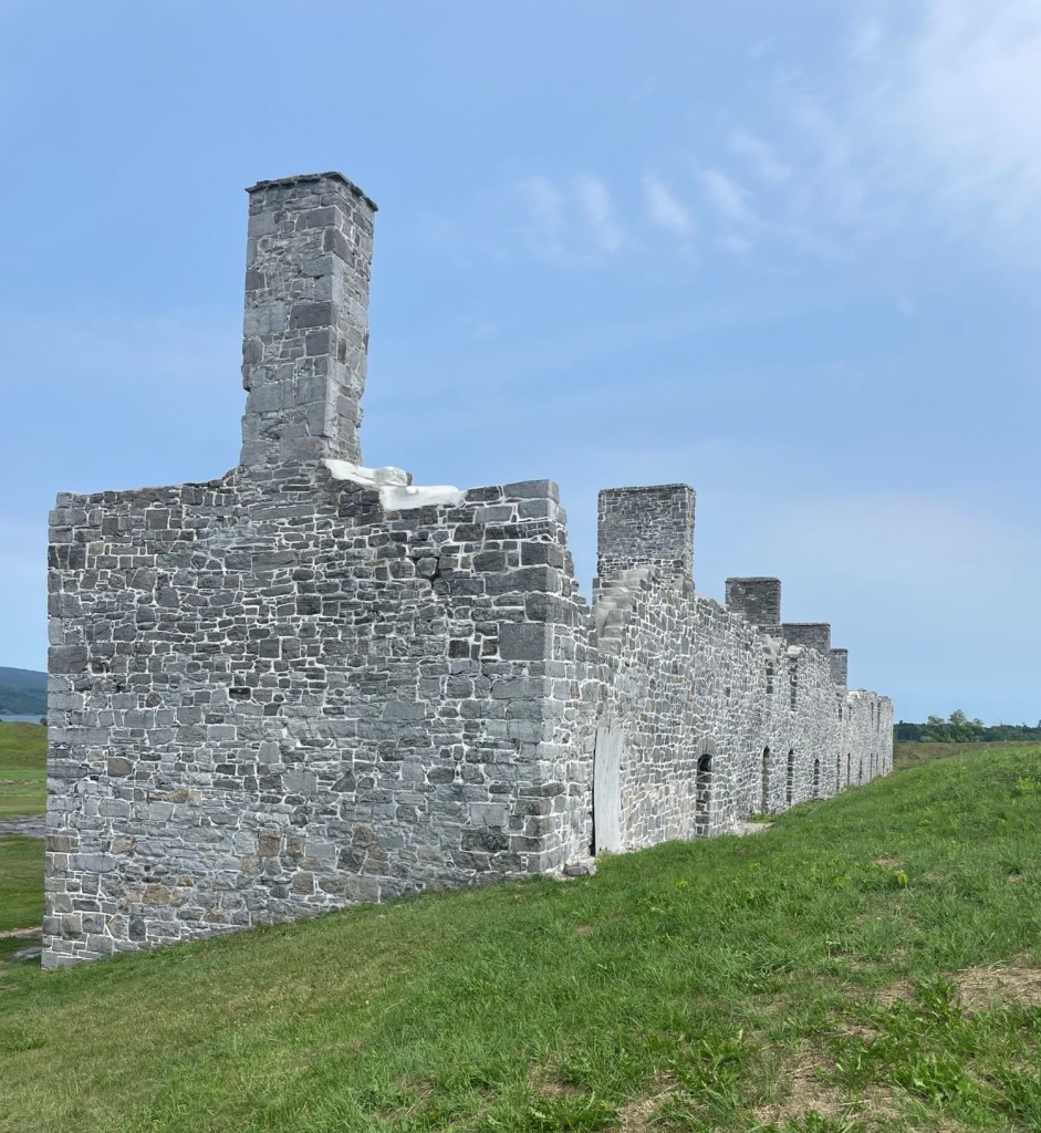
(Not yet, anyways.)
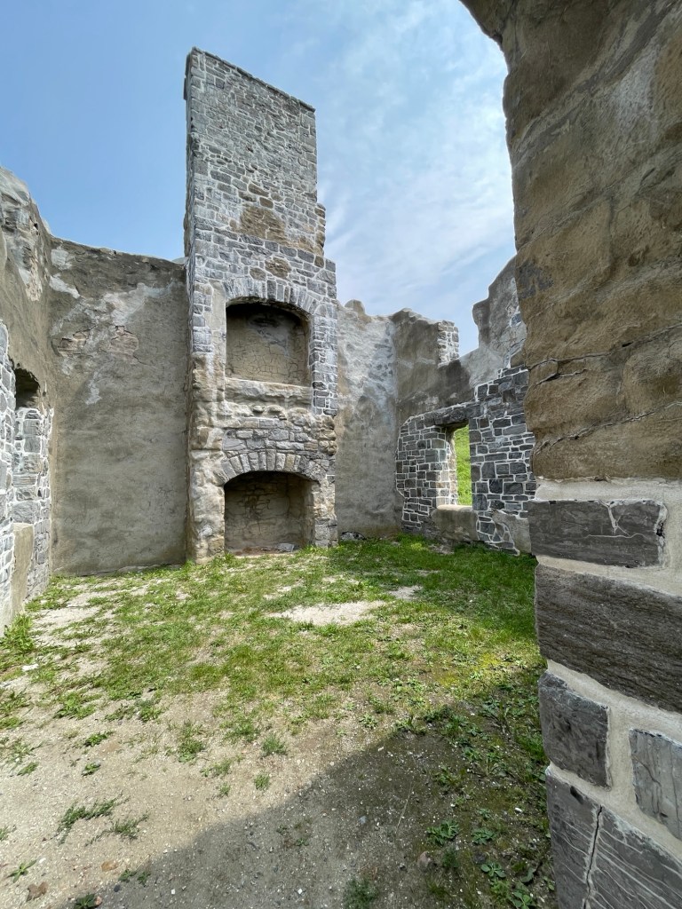
In 1773, a chimney fire spread to the fort’s wooden walls and then to the powder magazine, resulting in an explosion that destroyed most of the main part of the fort. With the fort in shambles, the hated French gone, and other areas causing concern (looking at you, Boston), His Majesty’s troops started getting sent to other points. By the time Vermonter and Continental Army Colonel Seth Warner and 100 Green Mountain Boys arrived in 1775, only a minuscule number of soldiers remained. They surrendered the fort and it began its slow melt back into the landscape.
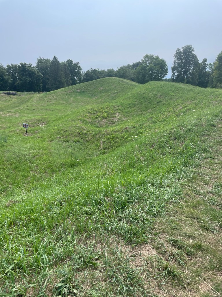
Crown Point was used intermittently as a staging area for the Americans and later for the British, but it never again played a substantial military role.
Side note:
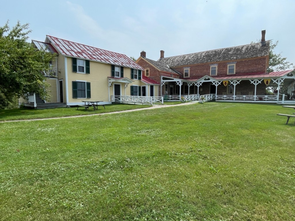
Not long after the war’s end, tourism to points vital to the American Revolution became a reality. And if there are tourists, there will be tourism-based businesses. Chimney Point, which saw it all, is no exception.


Leave a Reply