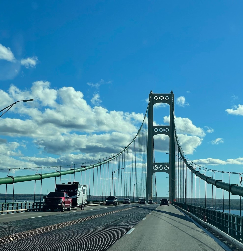
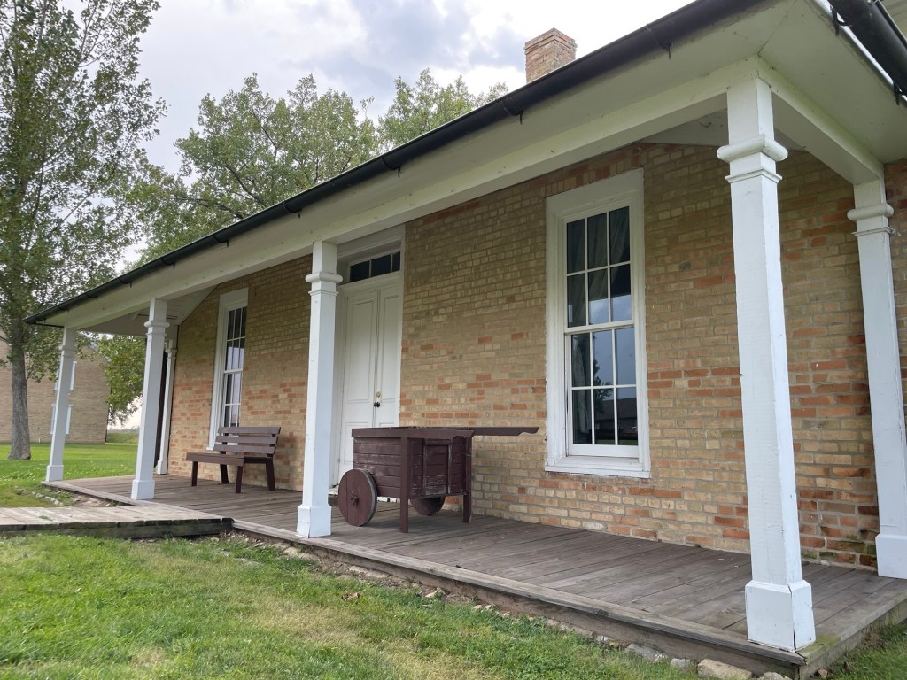
Mack-a-naw or Mack-in-awe, I’ve heard both, but it’s definitely not Mack-in-ack. Go ahead and take a sec to practice, if needed.
The Mighty Mac can be five miles of swaying suspension terror on high wind days, makes a truly horrendous sound when driving on the inner metal grates, and the edge rails feel far farrrrr too low any day of the week. That said, Michiganders in general love the Mackinac Bridge, straining to catch that first glimpse of the industrial green towers when about to cross from one peninsula to the next.
Up North
The 45th parallel marks the halfway point between the equator and the North Pole and is the unofficial definition to me when someone from the lower peninsula says they’re going “up north.”
We relaxed at the folk’s place Up North for over a week, eating, sleeping, doing laundry, putting puzzles together, seeing extended family, and just relaxing in general.
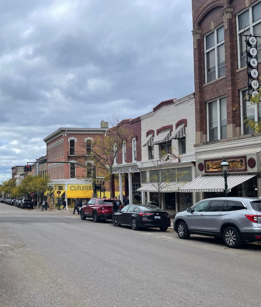
Petosky business district
There were a few side trips to Petoskey, Elk Rapids, and Traverse City.
Petosky business districtPetosky Harbor
But most of our time was spent hanging out, playing games, making jokes, and catching up. As you can see, it was pretty cloudy our entire stay up there, which is pretty par for the course near the Lake Michigan side of the state. Those giant inland seas have an outsized impact on the weather. The upside is these clouds create a giant, moody light box and if you catch it just right, good things happen.
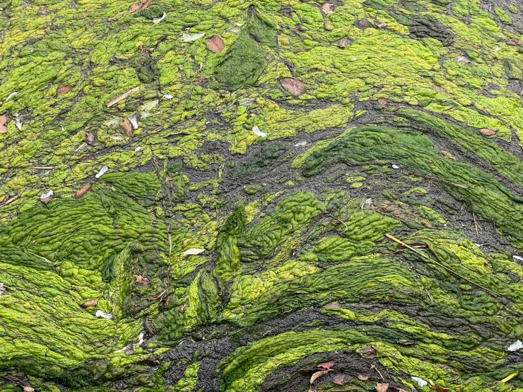
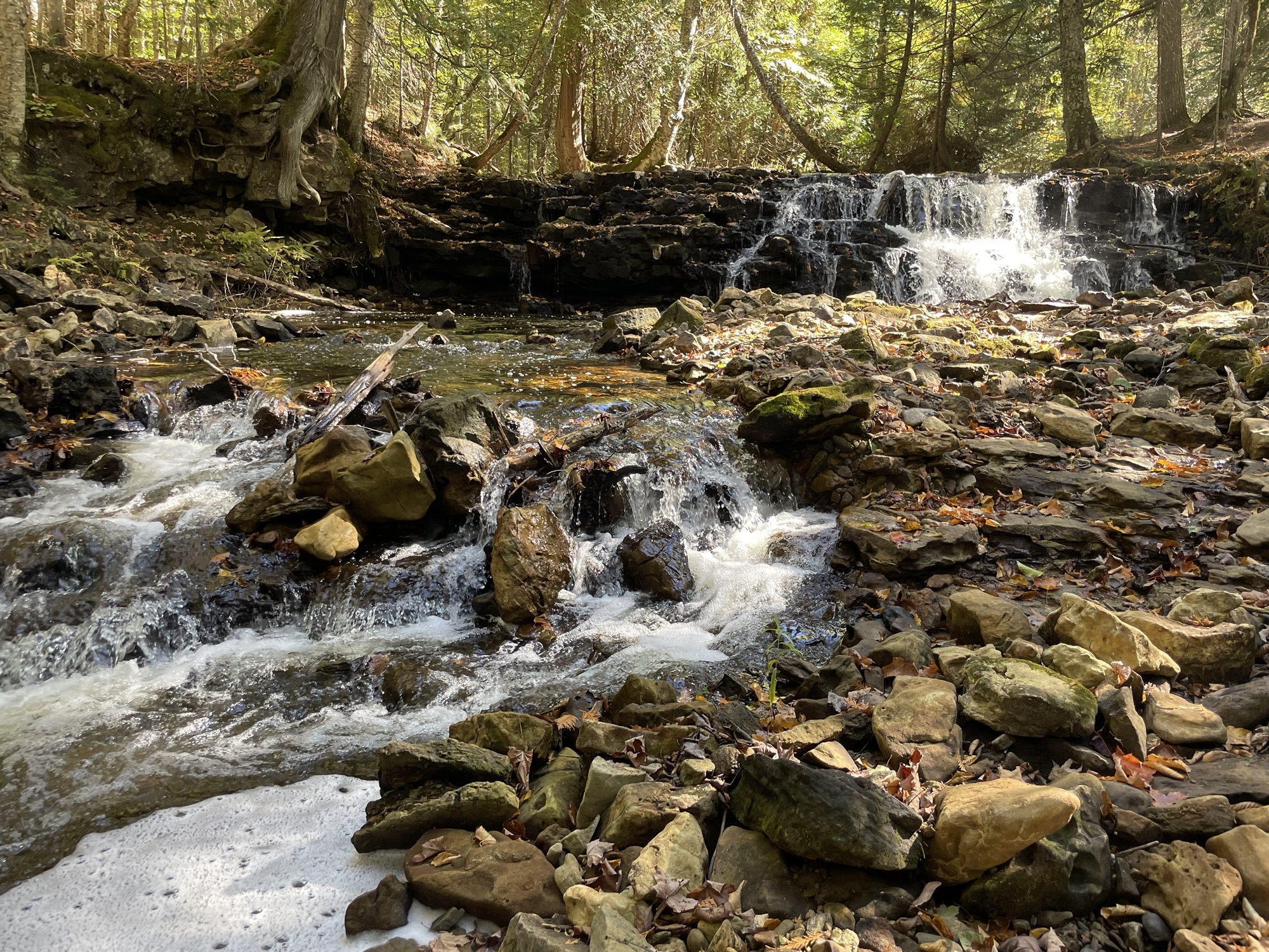
Seven BridgesEven pond scum is pretty from the right angle
Rugg Pond Dam’s claim to fame is that Hemingway is said to have once fished there. The dam is scheduled for demolition soon, with differing opinions on the desirability of that event. No matter the opinions for or against, the dam currently appears to be unstable and at risk of failure if left as is. Only time will tell what the long term effects of the change will be.
Rugg Pond
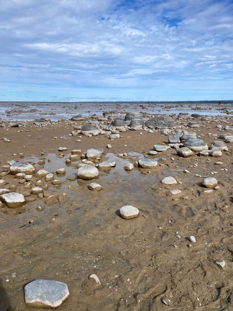
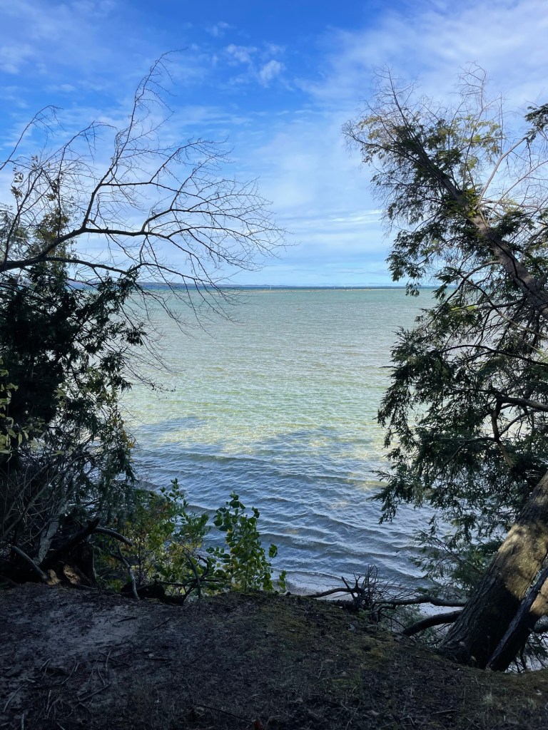
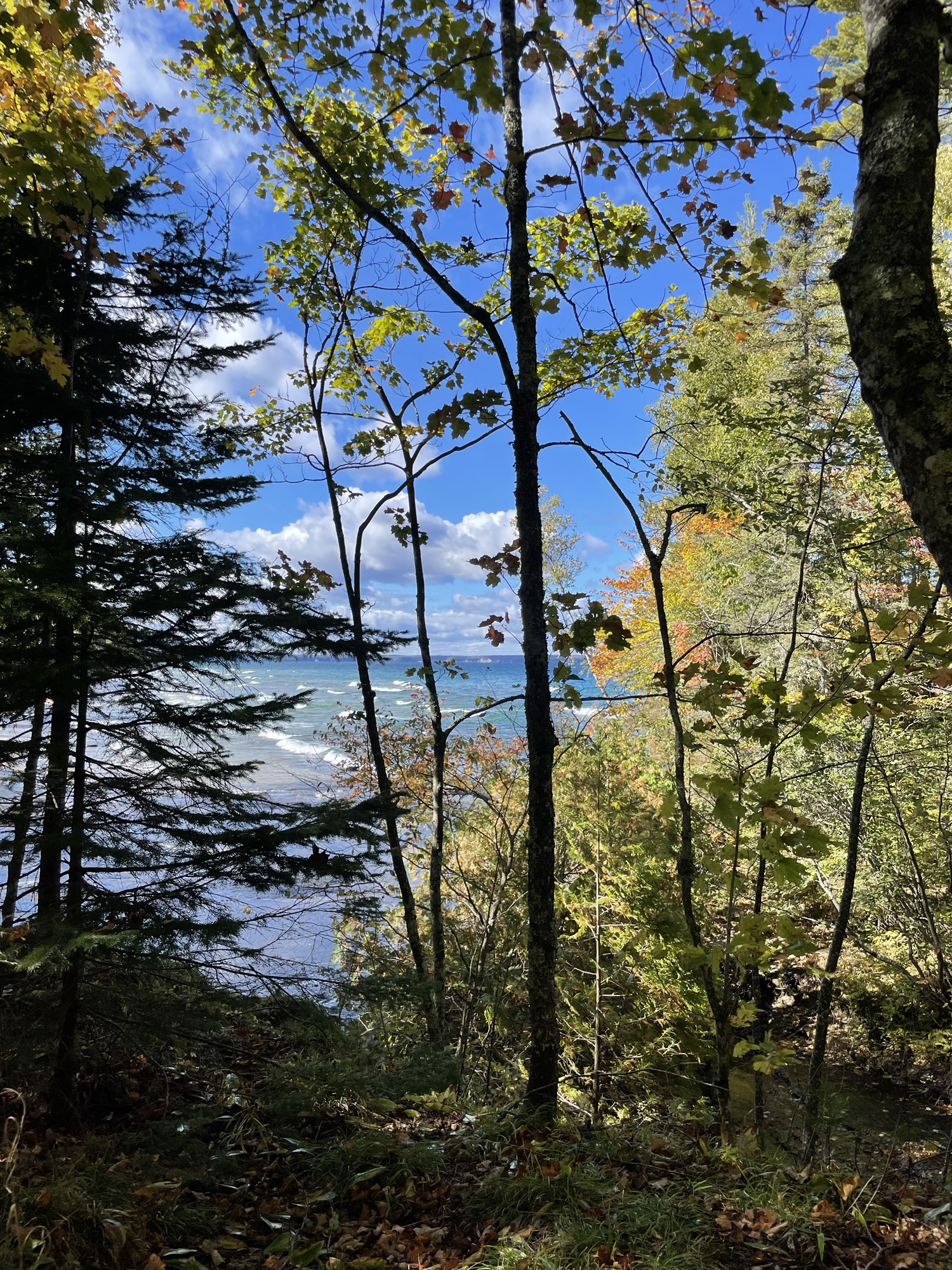
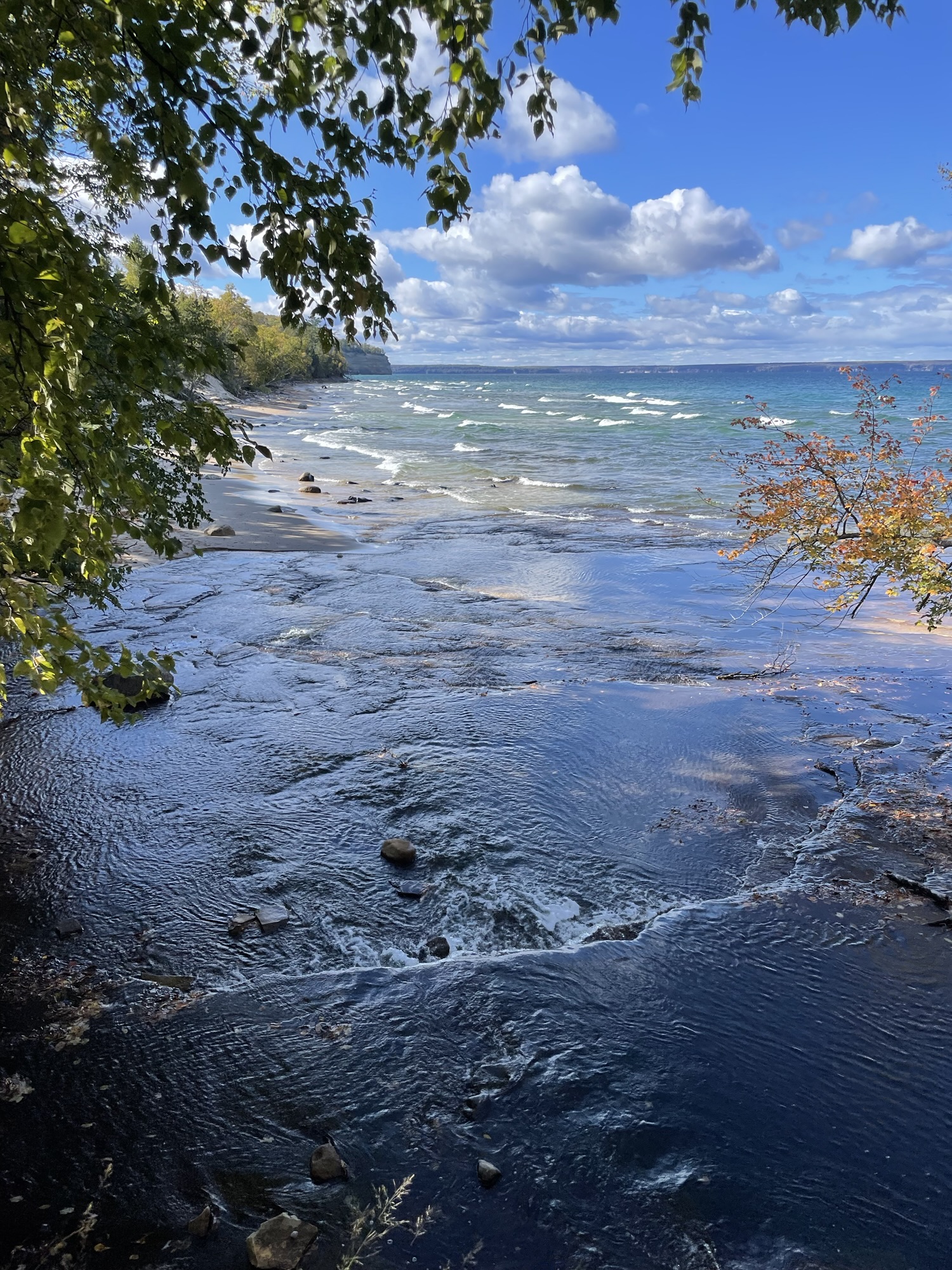
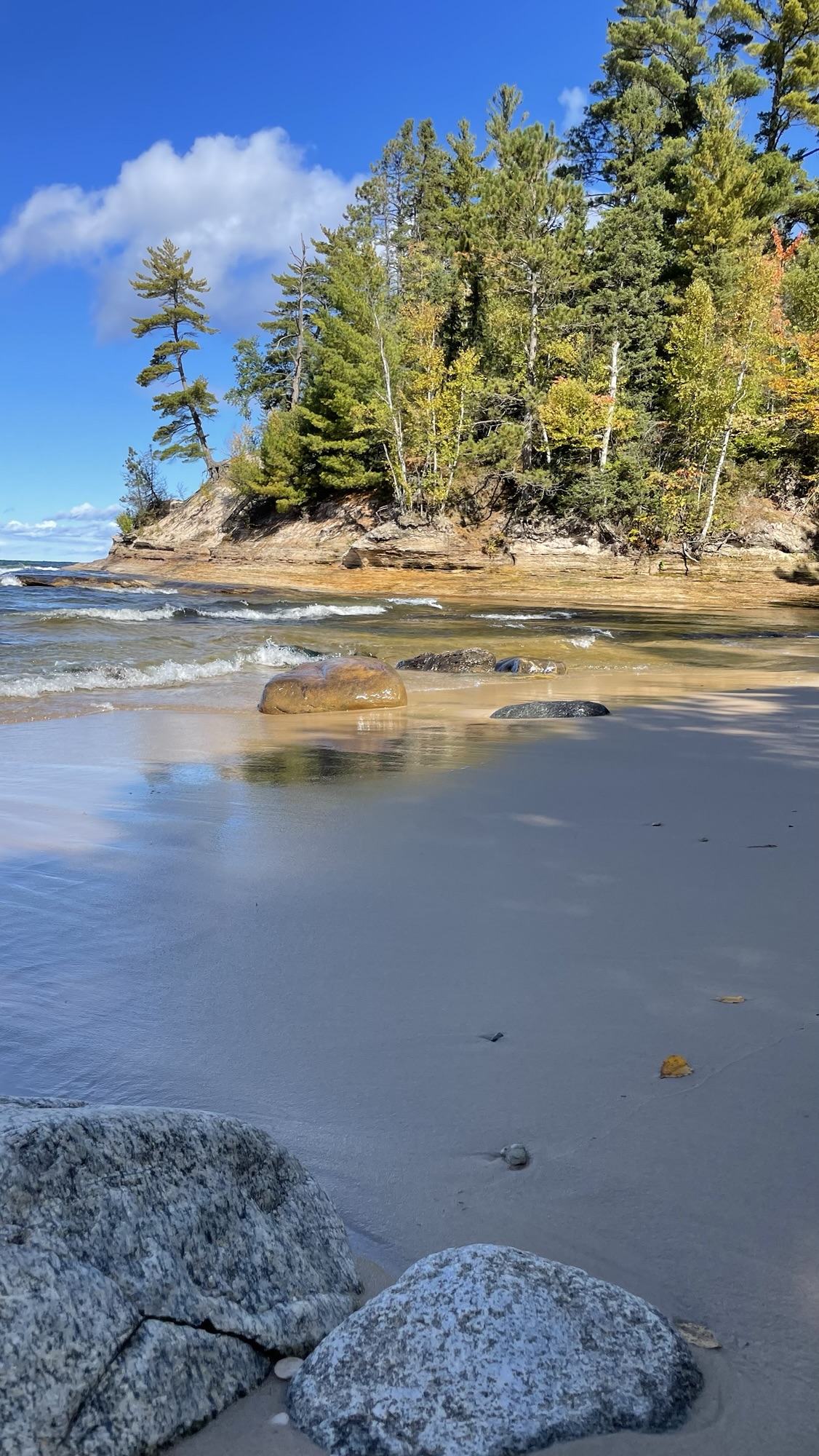
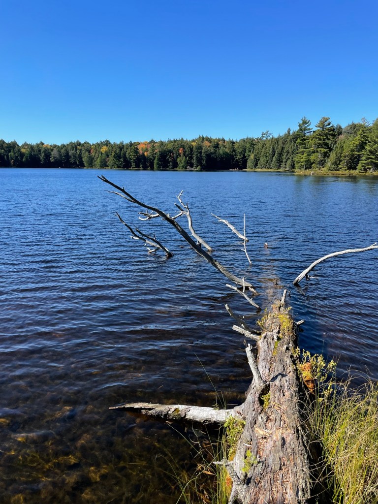
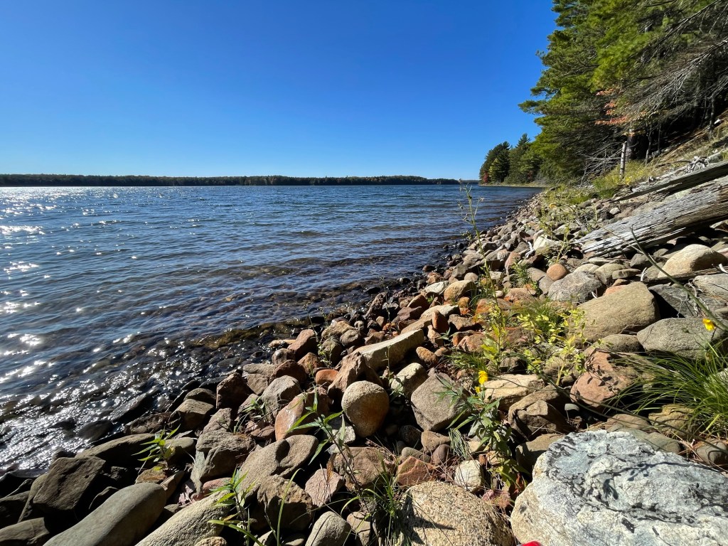
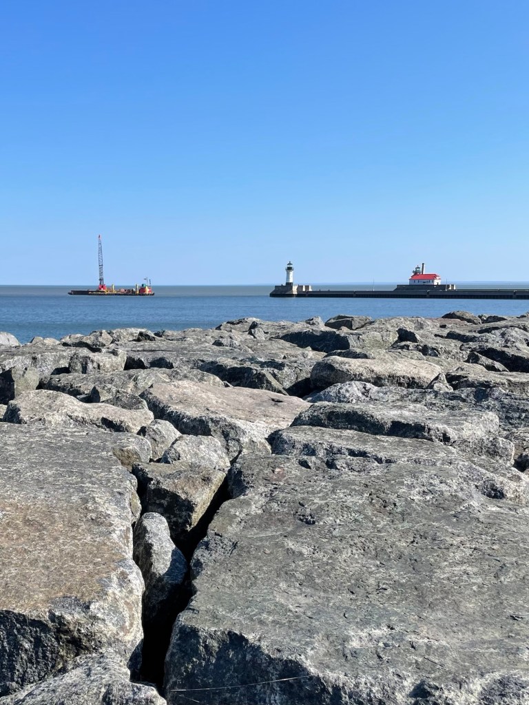
A drive through the Mission Point peninsula reminded us how beautiful the West Michigan shoreline can be. The Lake appears to be pretty low at the moment (yes, locals?) as seen by the water lines on these larger exposed rocks.
Mission Point shorelineAll kinds of crushed shells intermixed with the white sand
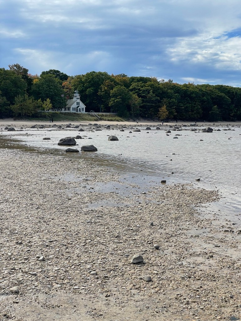
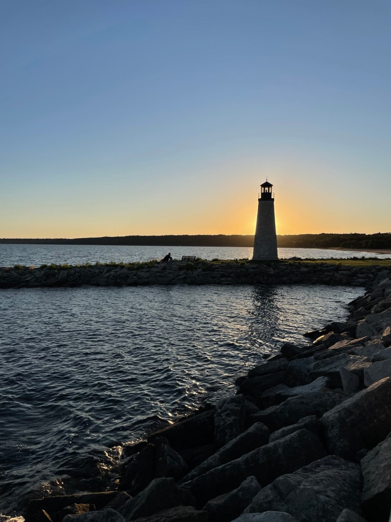
There are lots of decommissioned lighthouses along the miles and miles of Michigan shoreline, and I love them all. I’ll never not want to look at a lighthouse.
The decommissioned Mission Point Lighthouse
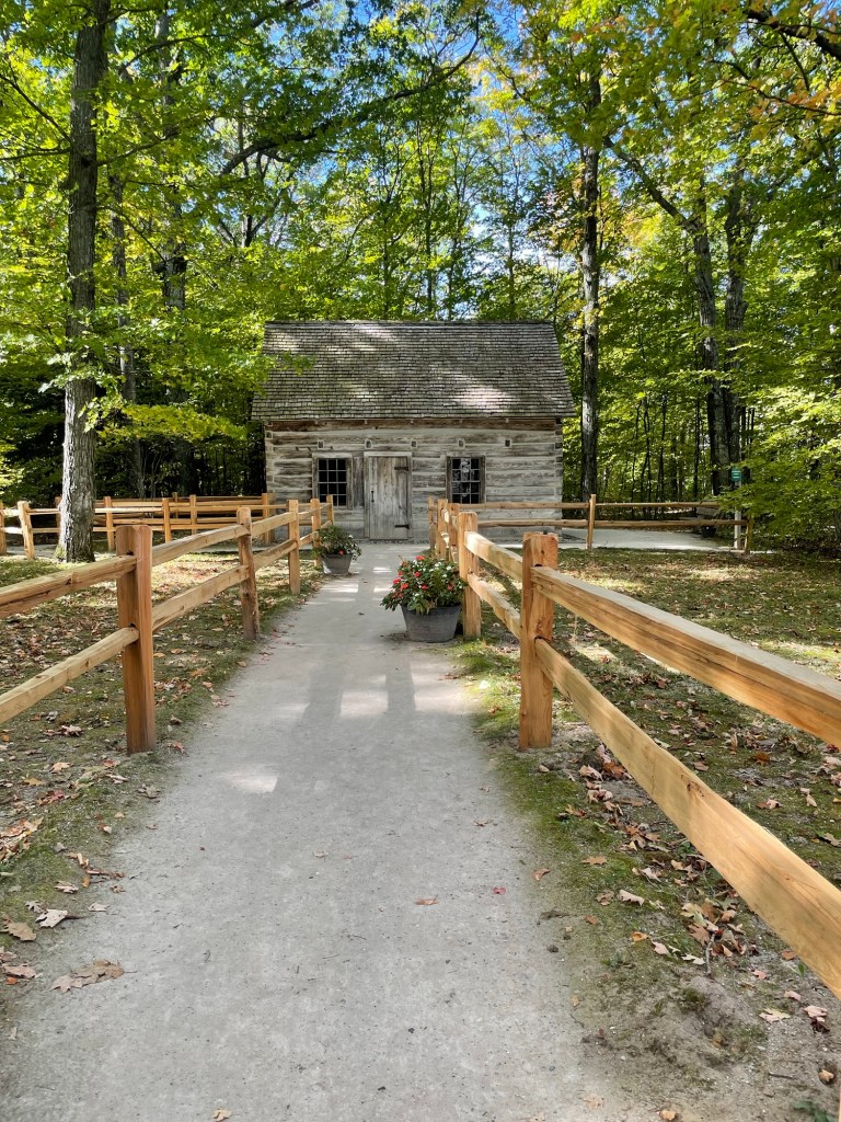
Throw a log cabin into the mix, and you might not get me back to the car before nightfall. Jeff is very patient with my ogling at log cabins and lighthouses, which makes him a veritable saint.
This visit’s saint maker log cabin Grand Traverse Bay, Mission Point side
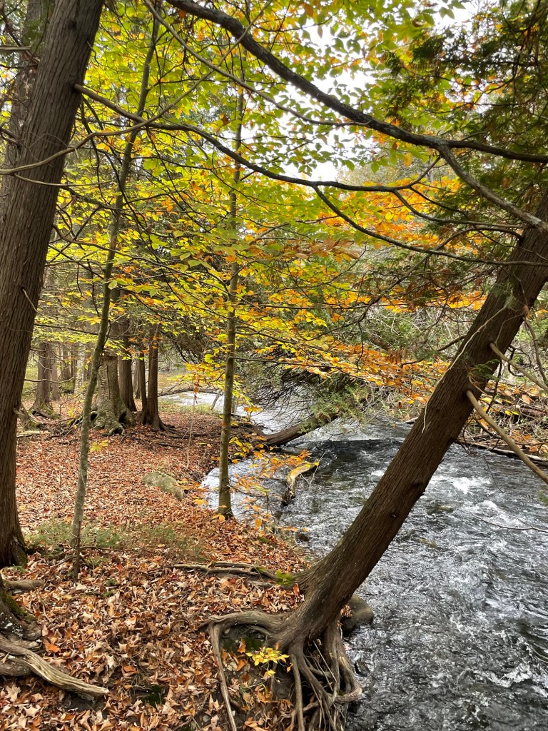
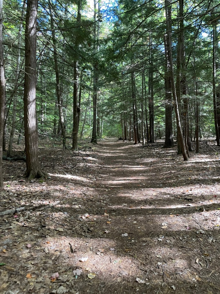
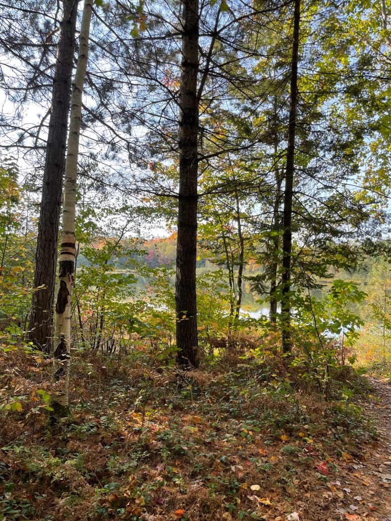
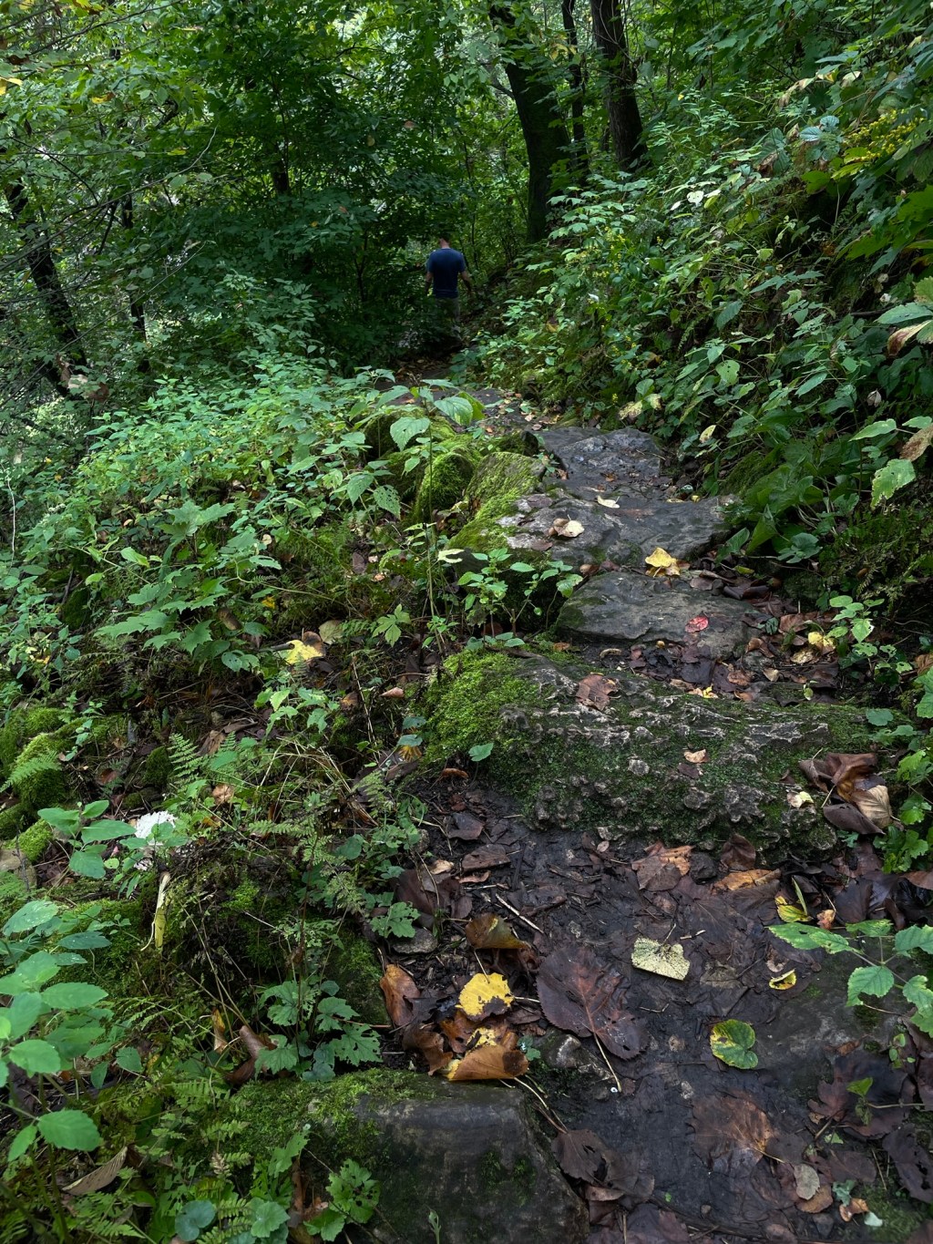
We walked around some short trails, through a hemlock forest. Don’t make tea from these needles.
Hemlock forest
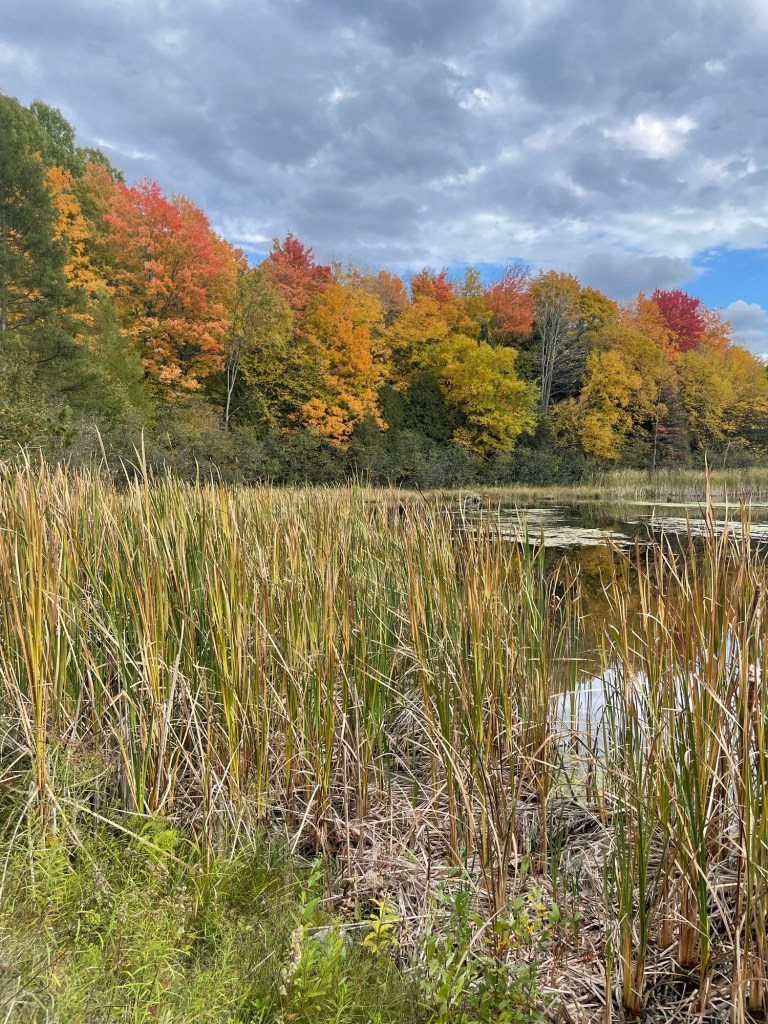
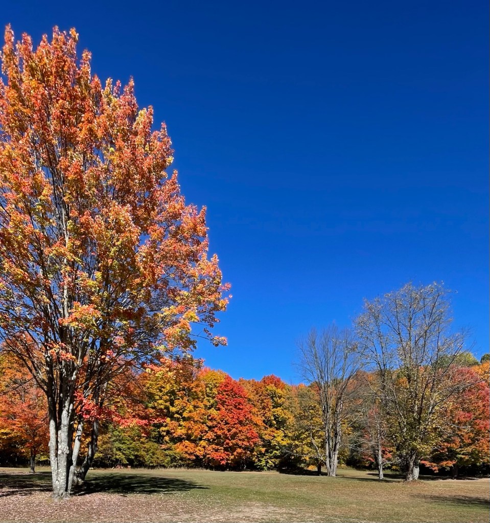
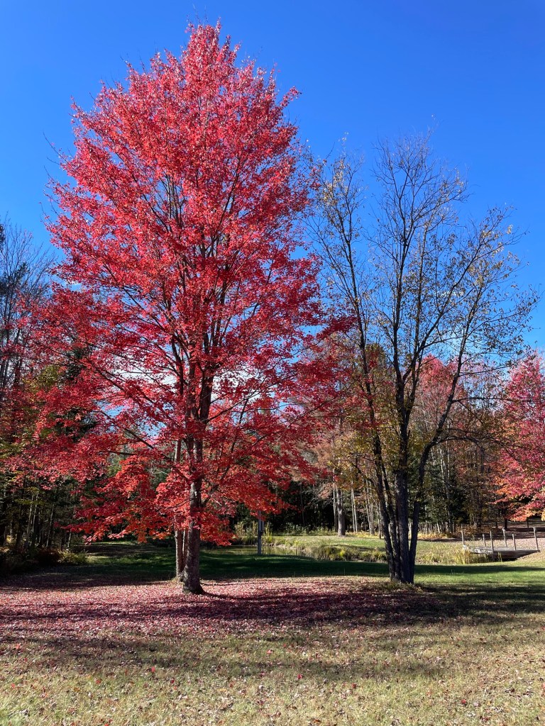
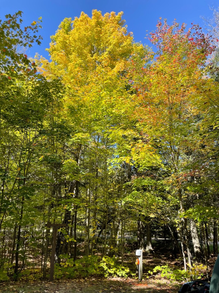
The cabin and surrounds were at peak color during our visit. I feel like we won the autumnal lottery this year, hitting one peak color spot after another.
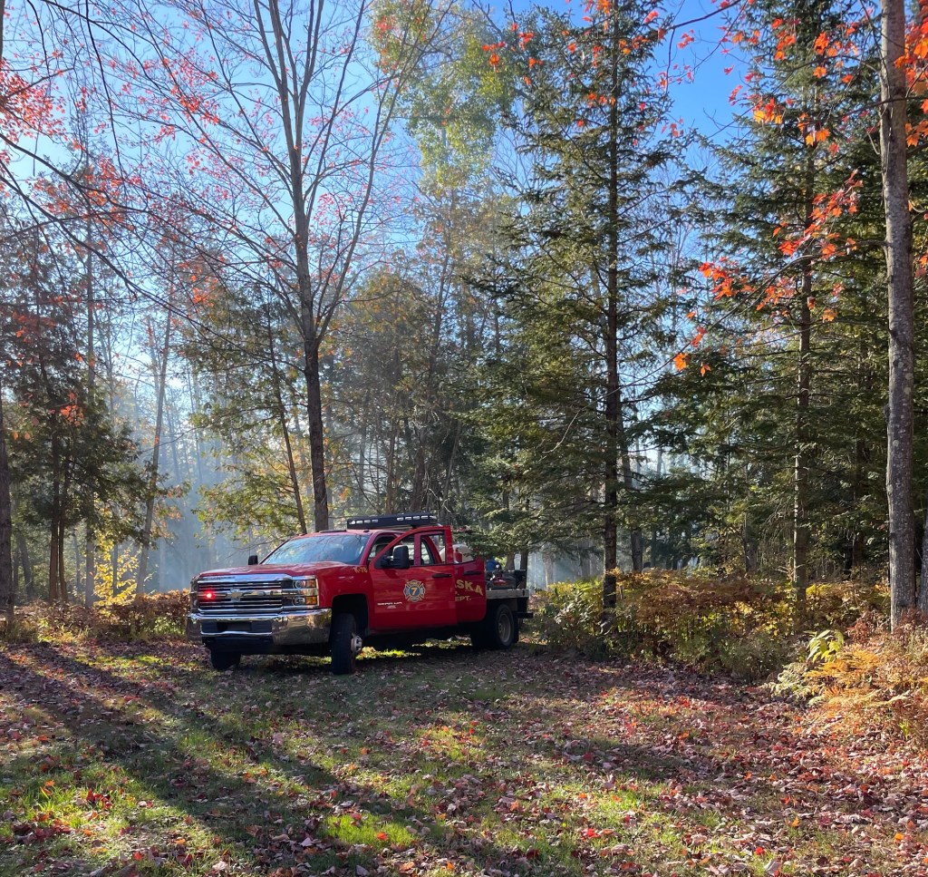
Peak colorMore peak colorSeriously, this is embarrassing It’s all fun and games until the fire department shows up
Right before we headed out, a neighbor called to warn us not to worry but we might hear some sirens. We heard some sirens. We saw some lights. Two volunteer departments arrived. Don’t say they don’t know how to have a good time Up North. Thankfully it wasn’t a big deal and the brush fire was knocked down and under control again even before the first truck arrived, but always better to be safe than sorry.
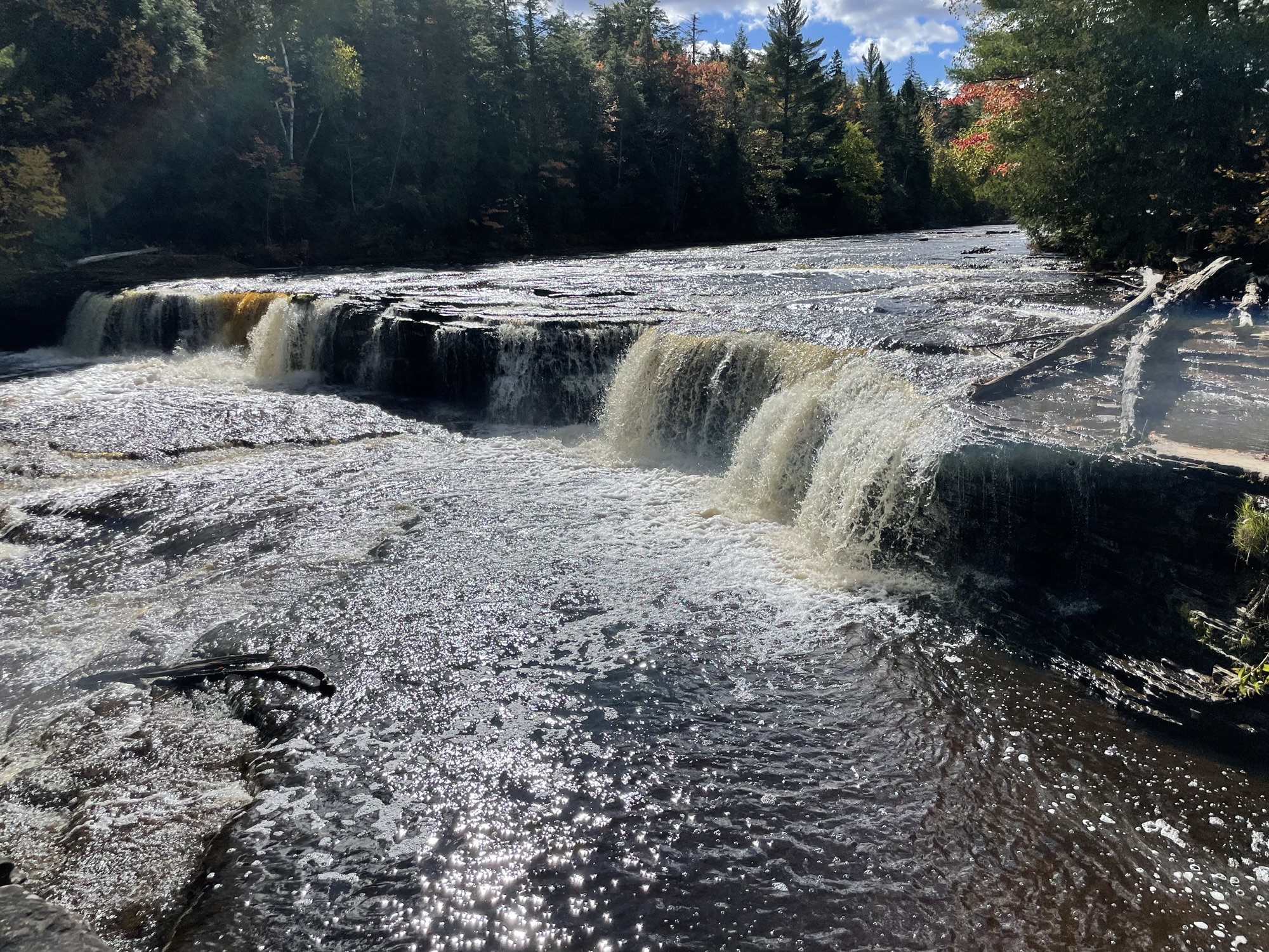
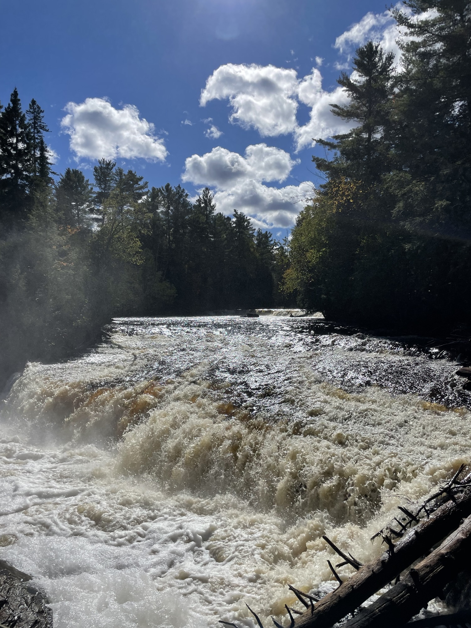
When we heard that some of our favorite people were going to be camping near Pictured Rocks National Lakeshore, we decided to head to Munising, MI. We didn’t know what to expect with the governmental shutdown, but even if we couldn’t get into the park, we knew we wanted to see Rob and Kate.
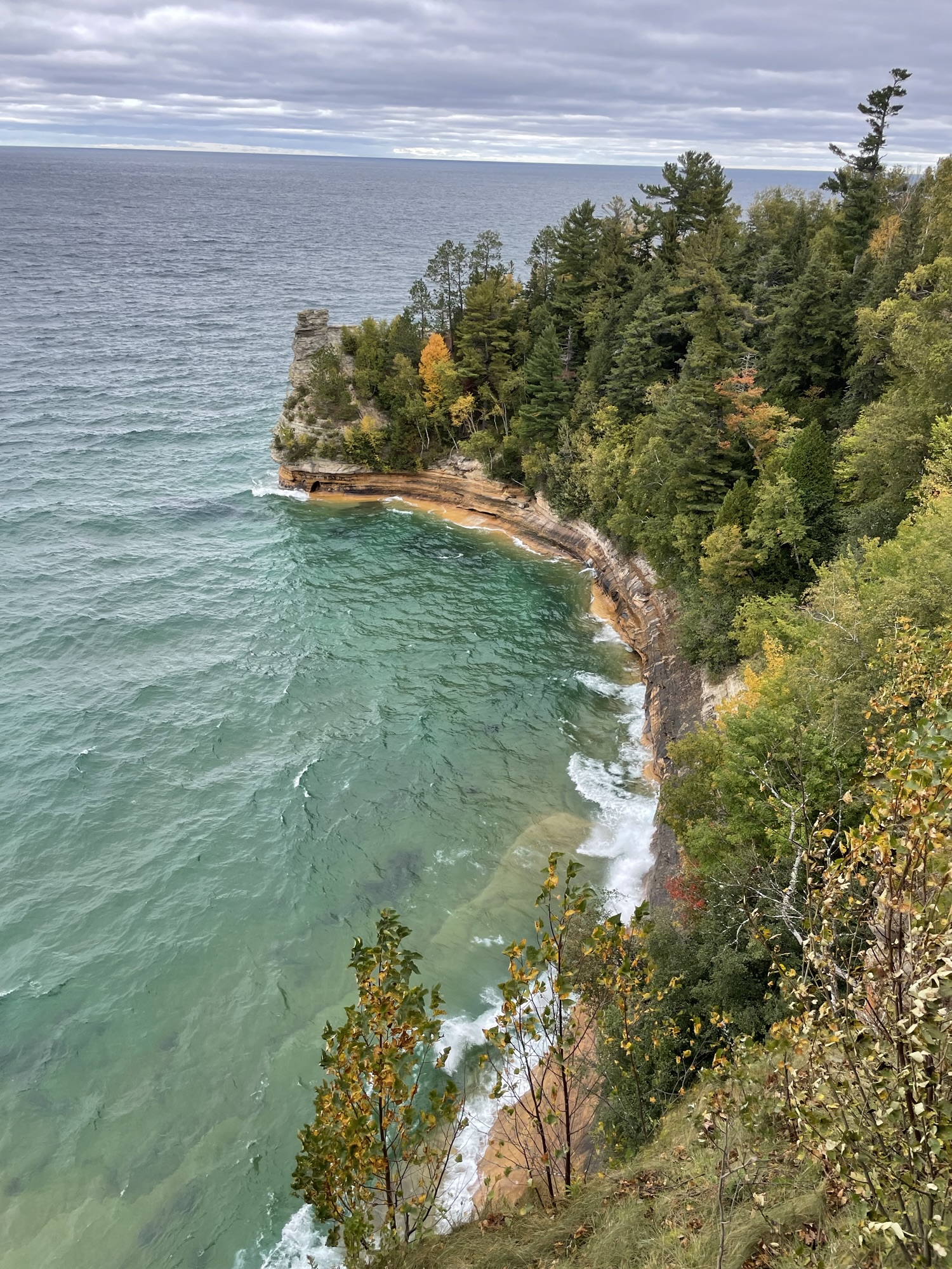
If you haven’t heard of Pictured Rocks yet, the region is all about water. Without a doubt, the best way to see the cliffs’ varied colors and dramatic rock formations is from a boat, but seasickness plus high waves kept Jeff and me on land. Visitors come to see waterfalls and the 12 miles of mineral-stained, erosion-carved sandstone for which the National Lakeshore is famous. Pictured Rocks was designated the very first National Lakeshore for a reason.
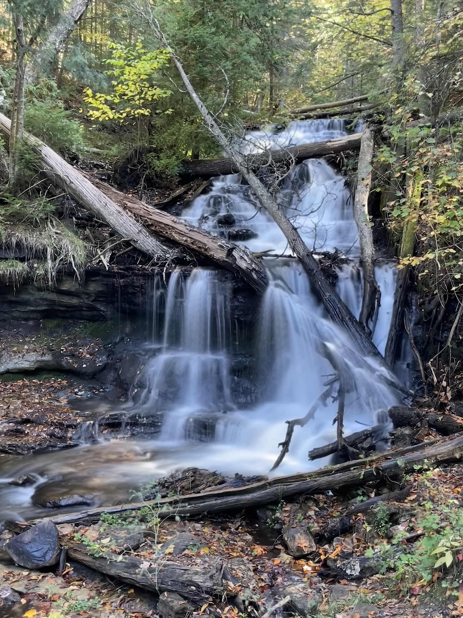
Because high waves caused their boat tour reservation to get pushed back two days, we headed out first to see some waterfalls. Rob and Kate are responsible dog owners, so they checked to see which ones allowed pets and which didn’t. The Visitors Center was closed, so we just headed to our first stop. I wonder how much revenue the nation has lost by not having Park staff on site to collect entrance fees or sell annual passes.
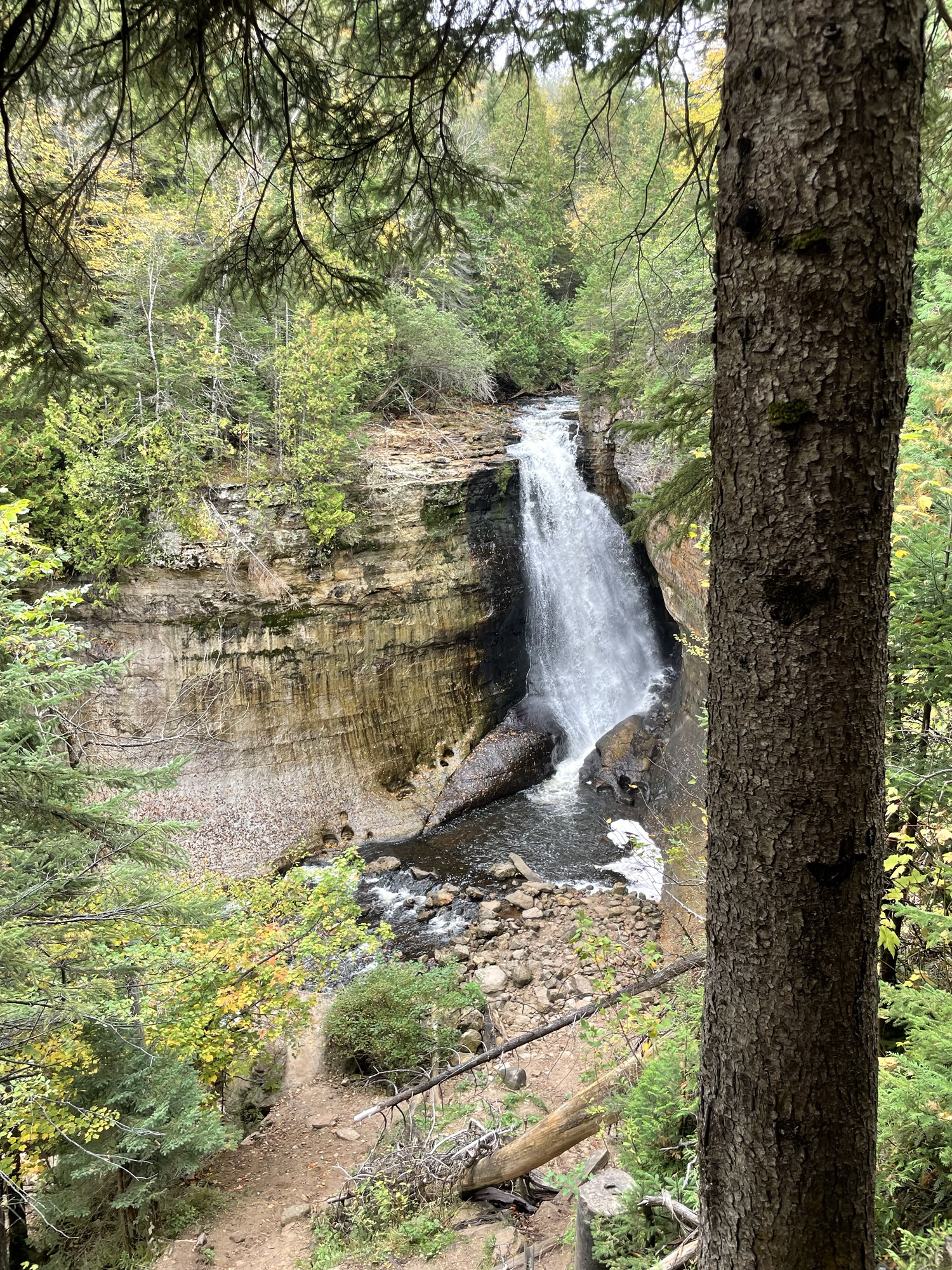
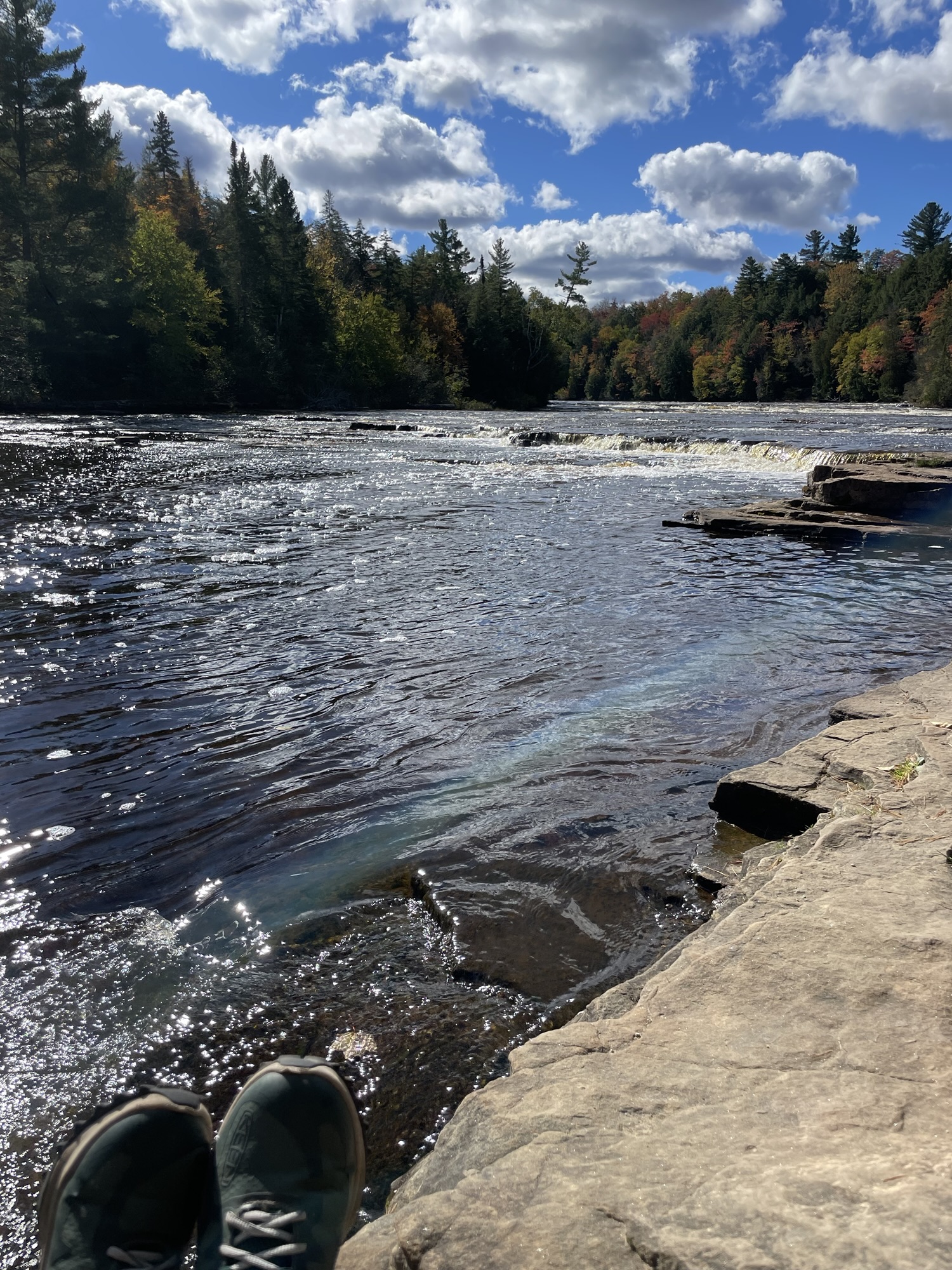
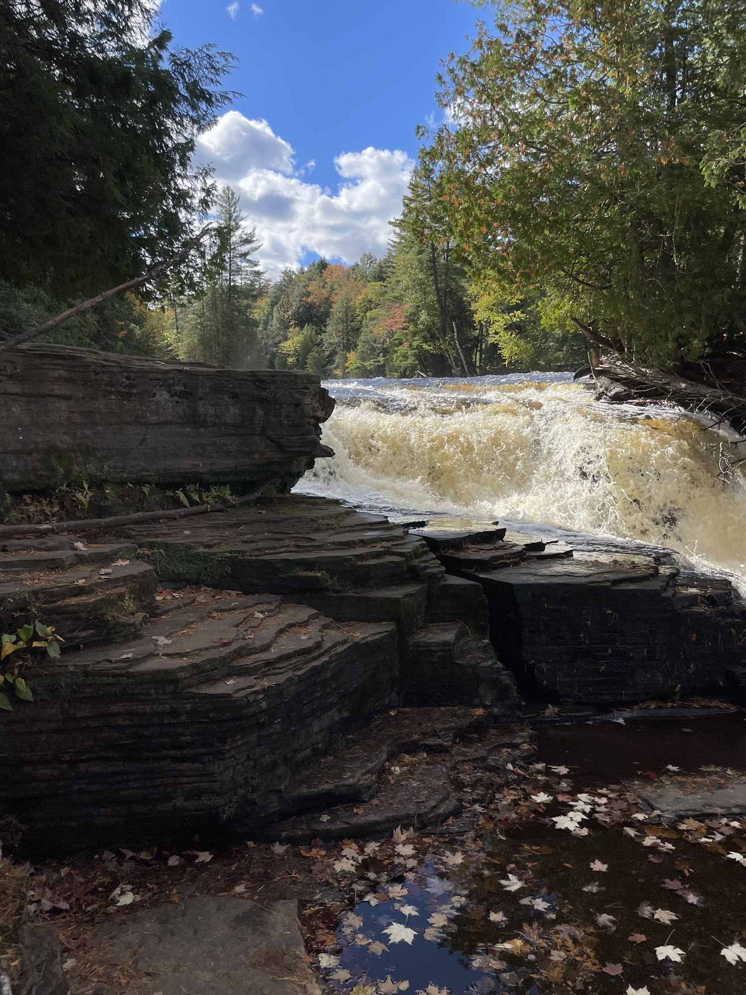
Miners Falls
Miners Falls is an easy, half mile walk from the parking lot, with two viewing areas. Only one requires a flight of stairs. Despite fences around the viewing areas, we saw a young couple climb over the railings to get closer to the falls. A quick instagram search shows me that the internet is full of people doing that during the governmental shutdown. It makes me sad and angry to see things like that going on, as the barriers are there to protect both visitors and the waterfall area, but I’m not surprised. Selfish and destructive people come out of the woodwork at times like this.
Anyway.
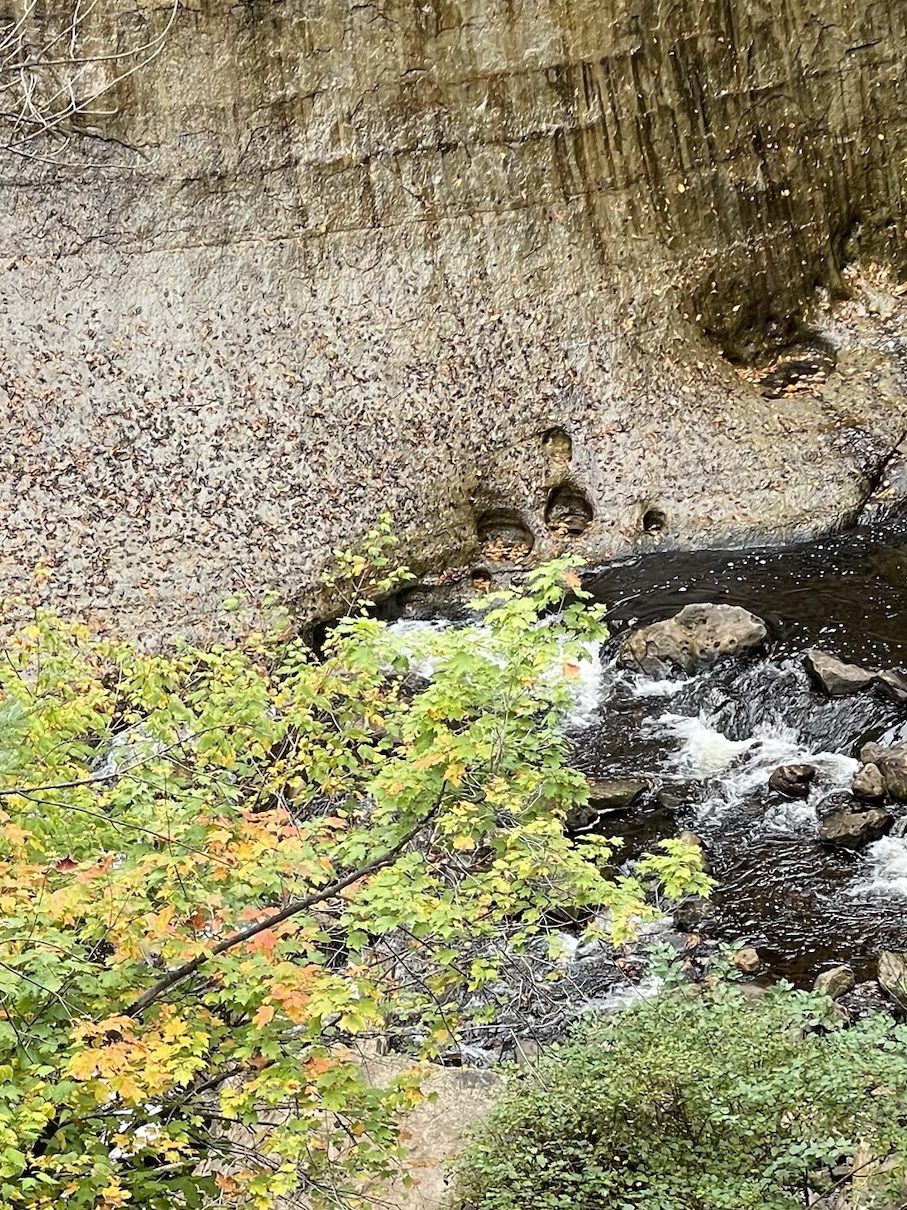
Did you notice the little circles at the base of the falls? They were created by water, rock, and a geological spin cycle. Called kolk basins, they’re formed when very fast water gets into a depression and spins a small object inside of it, eroding the slight depression into a deep, circular pit.
Yeah, I admit it. I’m feeling pretty good about the 20+ episodes of How the Earth was Made we watched last summer. Look at me tossing out geological tidbits on a whim.
This walk made me extra happy, because not only did I see kolk basins at the base of the waterfall, but I also noticed this big rock full of glacial scrapings on our walk back to the truck. What’s that, you want an explanation? Don’t mind if it do. As mega-ton glaciers advanced and retreated from the poles across the earth, rocks and boulders trapped beneath the ice sheets carved grooves into the landscape behind them. Geology, man. It’s pretty cool to see physical evidence of the changes the earth has undergone across eons.
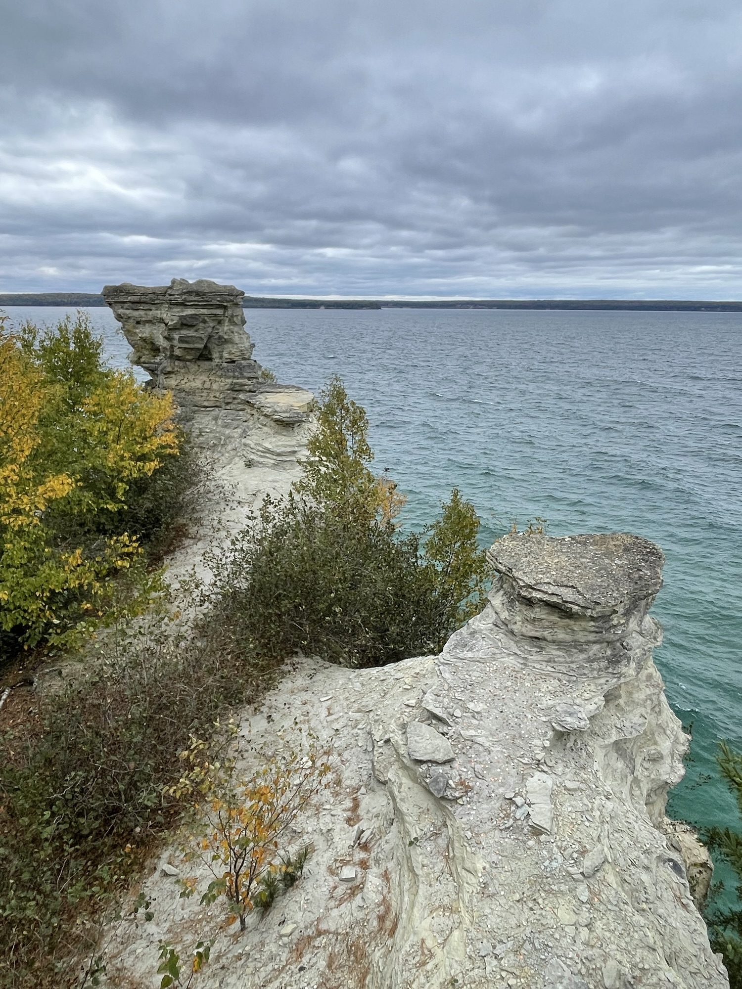
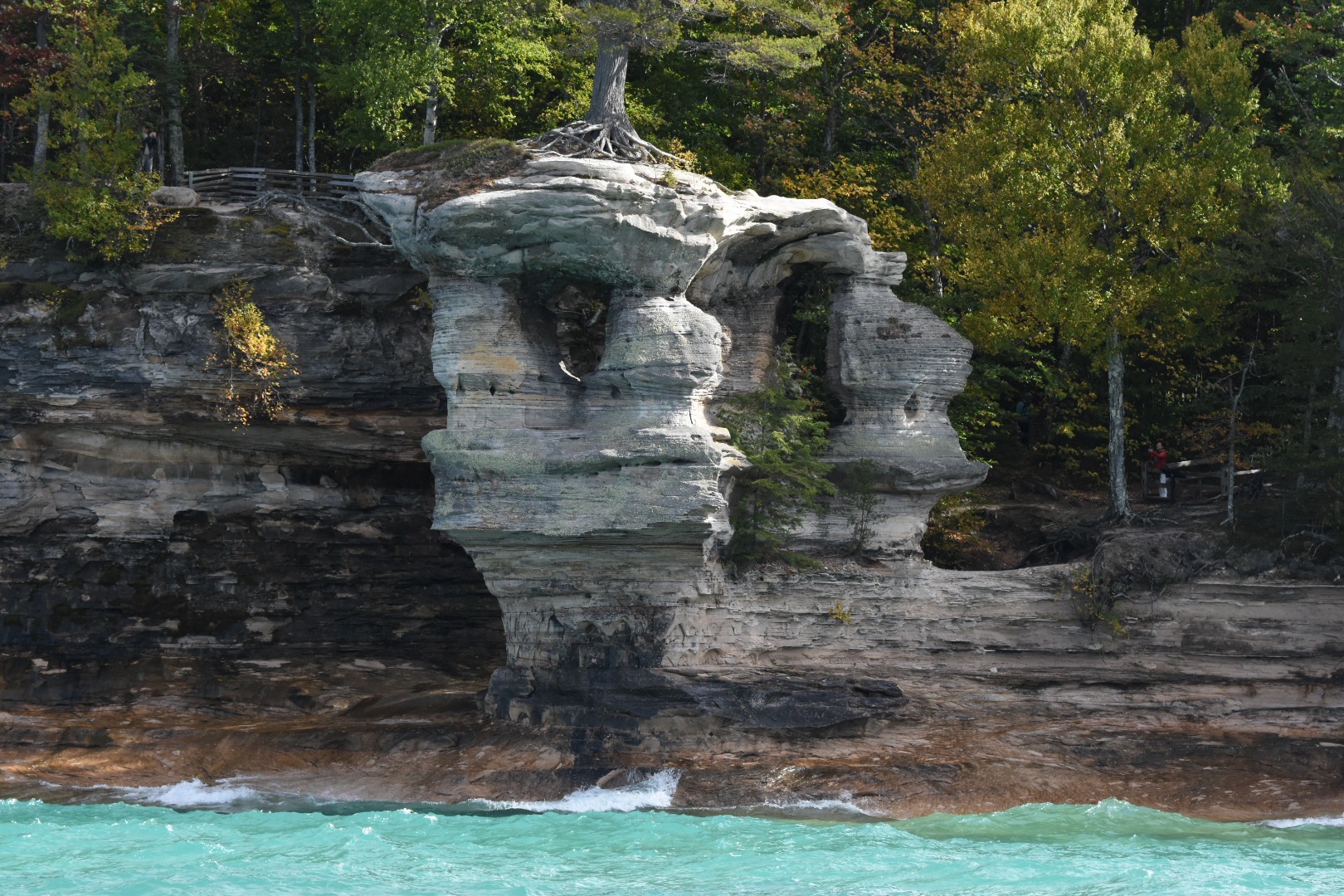
Miners Castle from the Upper Overlook
I want to start by saying that my photos can’t and don’t do the cliff’s colors justice, but again, turn that brightness up all the way and turn nightshift off to get the best shot at it.
If the sun had been shining and we’d been on a boat, the brown, orange, yellow, red, green, and black bands of color would have really stood out. But trust me, no one wants a seasick Jeff on their boat. (I recommend you go to the Pictured Rocks NL website to see what the pros have captured.) From up above on the observation decks, you get a good look at the stunning water variations though. Every shade of blue and green seemed present out there.
Miners castle, minus a turret
When we were here 20 years ago (‘Back in my day…’), the Castle formation had both its tall turrets, but erosion is a sandstone fact of life, and a rockfall back in 2006 took one of the tall turrets with it in a race to Lake Superior. The formation must be fairly unstable because there are signs ev.er.y.where stating, point blank, that you are “highly unlikely to survive a fall” from this cliff. You just know people are still doing it though. Stupid is gonna stupid.
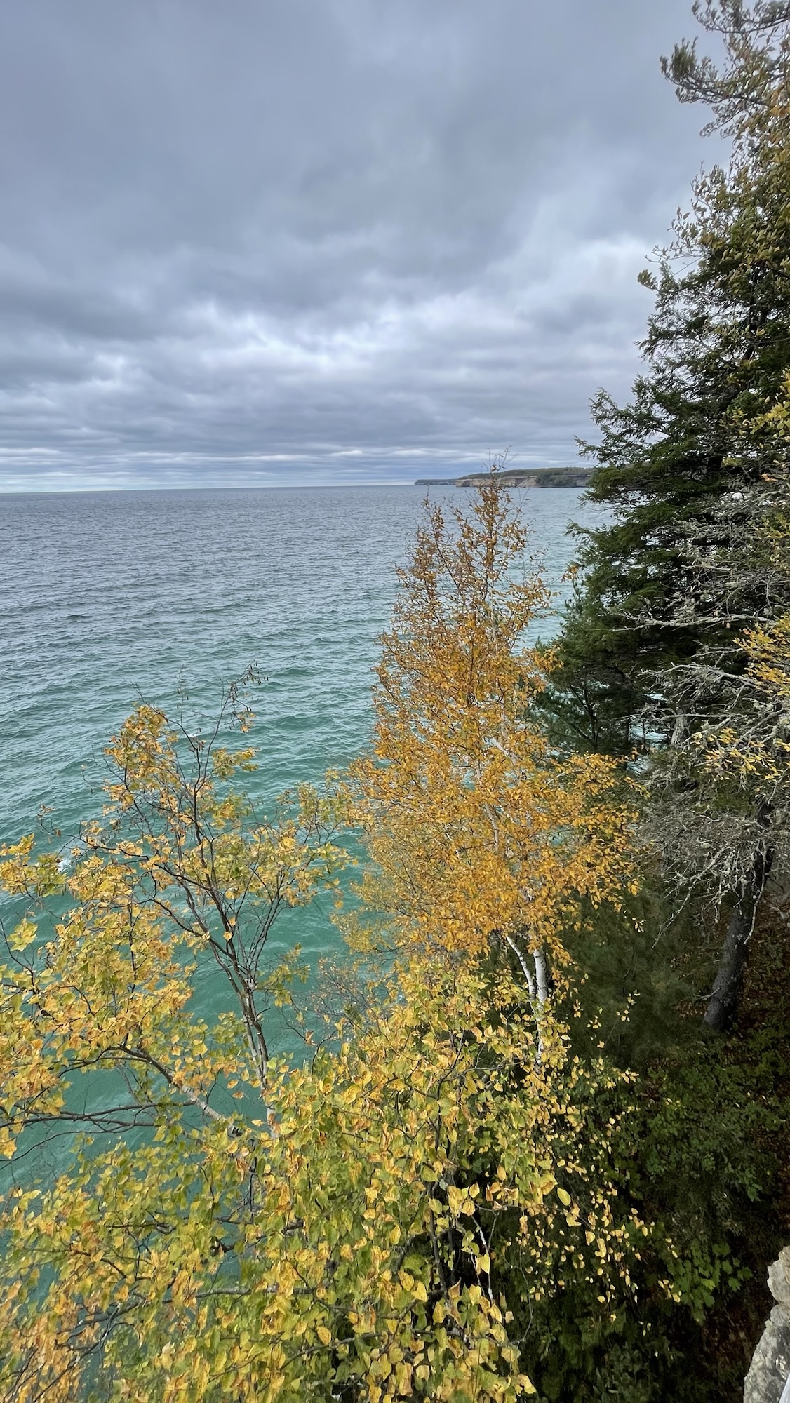
Looking east from the Miners Castle eastern viewing platform
I would like to note that it made my eye twitch not placing an apostrophe between the r and the s when typing Miners Castle and Miners Falls, but I didn’t do the naming.
Moving on.
The following morning, we all headed over to Wagner Falls and I broke out my iPhone’s long exposure setting to get this waterfall effect. All the pretty, none of the skill.
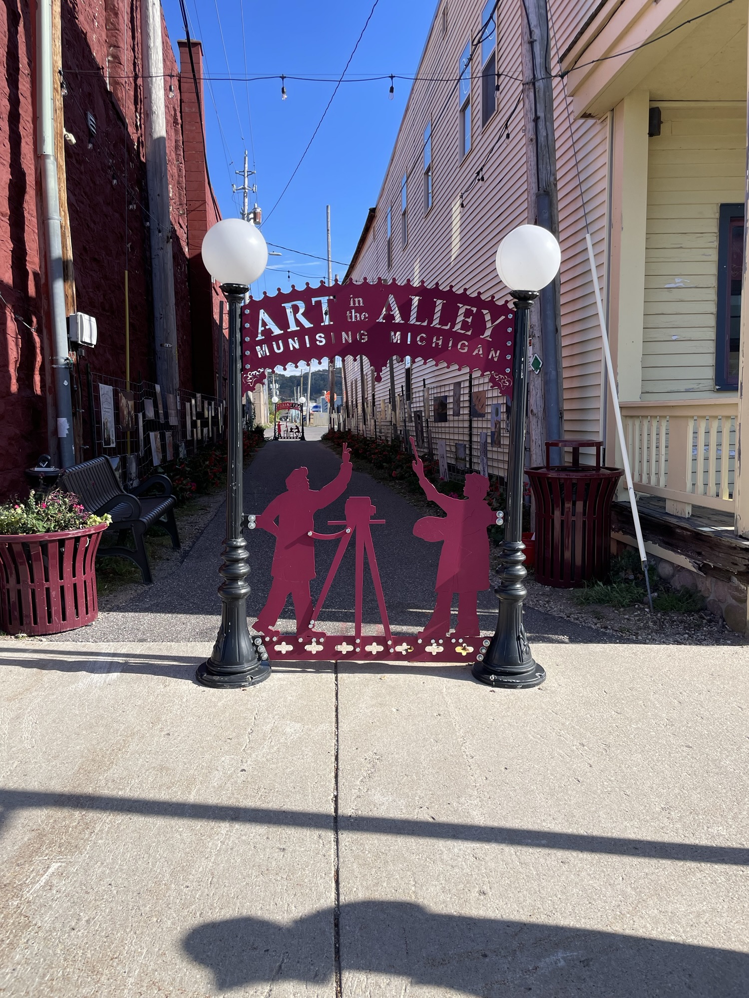
After that, Rob and Kate took the dogs for a drive and Jeff and I checked out the town of Munising. He and I started at the Pictured Rocks Interpretive Center and then walked around the neighborhood.
We found this sweet Art in the Alley corridor, each finding a local artist whose paintings spoke to us. I only wish I’d written their names down. Rookie move, I know. Still, I think it’s pretty encouraging to see even a small community like Munising devoting part of their commercial district to promoting and highlighting local artists.
Overall, it was a very nice day of hanging out together and doing our own things. Later, we all headed to Muldoon’s to dine on the only thing you simply MUST have while visiting the northern half of the Upper Peninsula — a Cornish pasty. That’s past-ee, by the way, not paste-ee. Let’s keep things clean here.
What’s the story behind this tasty link between the U.P. and Cornwall, England? Well, copper and iron mining were once major industries in the U.P., and some of the world’s best miners came from Cornwall. When they emigrated to work the mines, they brought their tradition of handheld mining meals with them. Since they worked long hours completely below ground, the miners could pull a hearty warm meal out of their lunch tins without hassle. (For the record, Kate makes a really delicious pasty herself.)
Mosquito Beach trail
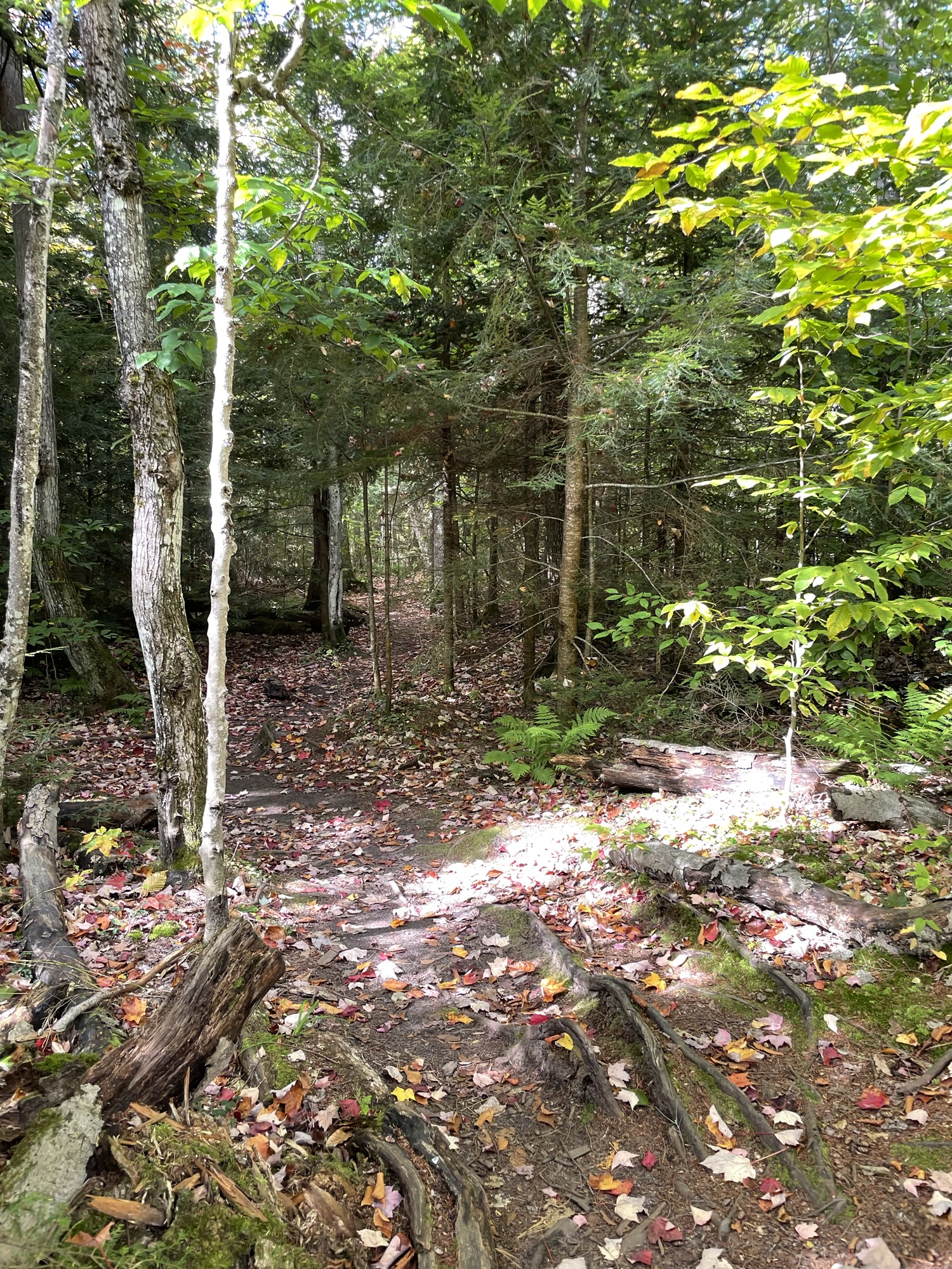
The following morning, Jeff and I headed to a no dogs allowed waterfall trail while Rob and Kate prepared for their rescheduled Pictured Rocks boat tour.
The Mosquito-Chapel parking lot was pretty full of vehicles when we arrived, but we hardly saw anyone going on the Mosquito Beach and Falls loop. Nearly everyone turned towards the taller Chapel Falls instead. We didn’t mind.
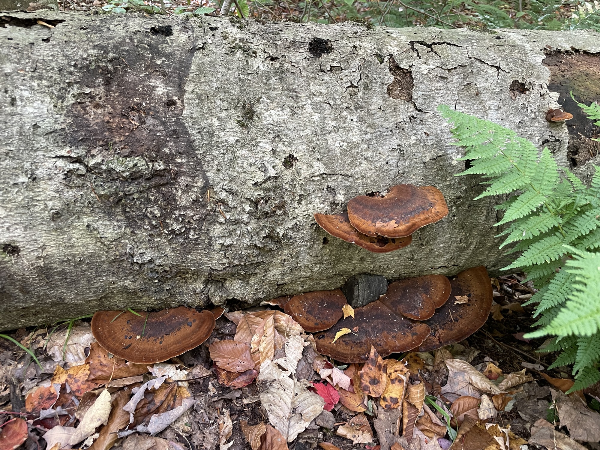
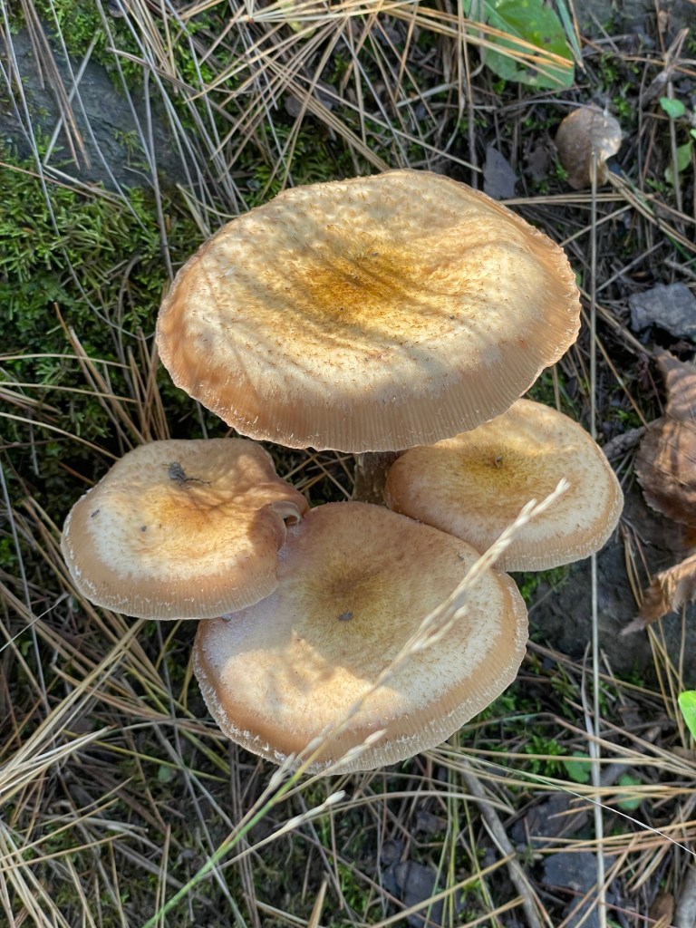
Resinous Polypore
Dine or Die had an impressive new contestant last week. Without looking it up first, what’s your vote on this firm, brown shelf mushroom? I think the darker central ring should get bonus points for ominous flair.
We were very grateful that the Mosquito Beach and Falls trail didn’t live up to its name this visit, but I wouldn’t count on it in the height of summer. My guess is that some recent hard frosts and cool temps had killed off this year’s batch. Good riddance to them.
Mosquito Beach
We noticed some backwoods camping sites, heard the crash of waves, and then suddenly Mosquito Beach peeked through the trees in all of its white sand and turquoise water glory. Later, we heard that—according to the boat tour guide—backcountry campers are known to enjoy some baignade nue time on that beach, much to the surprise of boat tour guests.
Not a soul in sight, clothed or otherwiseImagine the power of a glacier to carry and deposit erratics such as these (thanks, PBS for teaching me so many cool things over the years)
We followed the return path toward Mosquito Falls and were reminded that water always runs downhill. It wasn’t a steep climb back up, but it certainly wasn’t as quick a hike as down from the parking lot either.
Mosquito Falls
It’s just a small waterfall, but it gave me such joy — and not just because it was our hiking snack spot. We roamed around it from all angles, with me taking more photos than was reasonable because that’s what I do. We stayed on the trail as instructed, of course, because it’s the right thing to do to protect our public lands. I may still be chasing those gold stars from 3rd grade, too. Only a trained professional could say for sure.
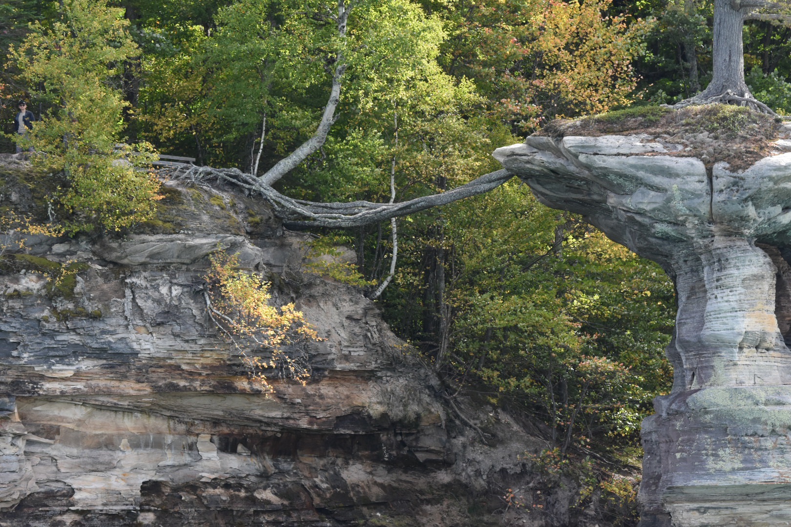
One of the things I most regret about not seeing Pictured Rocks from the water is missing the chance to see Chapel Rock’s famous tree. Rob was kind enough to share two photos of it and I found 99.1 WFMK’s fantastic write up of it online.
“If there were a Mount Rushmore for trees in Michigan, the scrappy little pine in Pictured Rocks National Lakeshore on Chapel Rock would be dead center holding a pasty. If Paul Bunyon had a bonsai, it would be this tree.”
The article goes on to note that this lone White Pine is older than the US itself, having begun to grow when the region was still part of the British territory of Quebec. Not bad for a tree whose entire nutrient system now lives on another rock which spans the open air and defies the elements to deliver the goods. Long may you defy all logic, you magestic Pinus strobus.
Chapel Rock, photo by RobThe lifeline, photo by Rob
And suddenly it was time to say goodbye to our friends and head out, but not before we mooched a little more coffee from their RV’s plush setup.
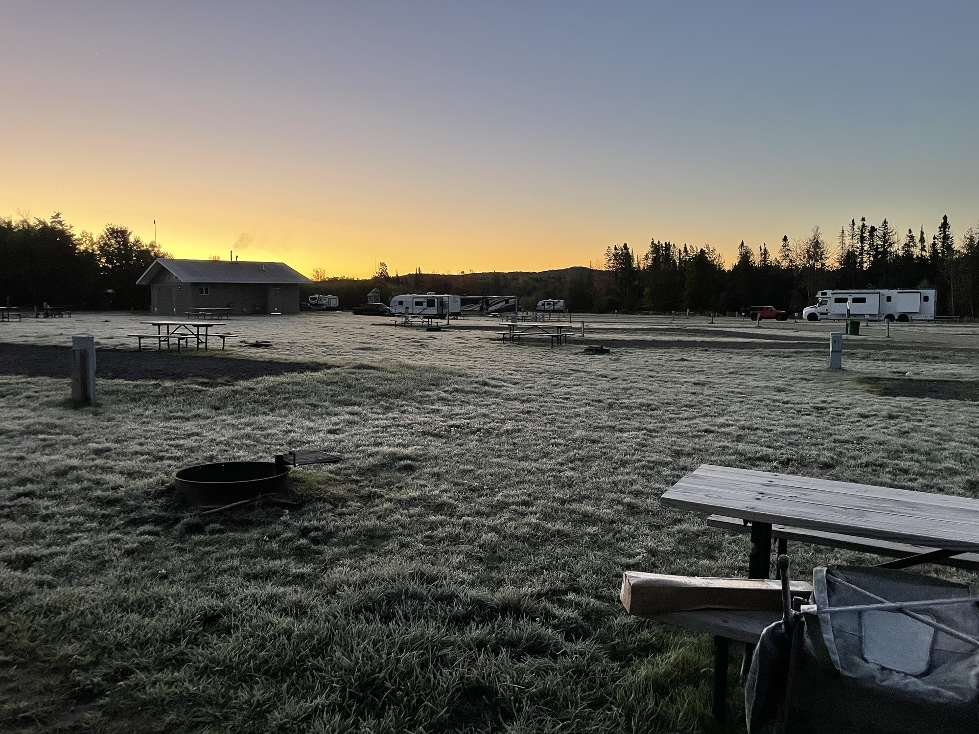
Sunrise frost
After breakfast, we headed out to the scene of one of our favorite memories, the Lower Falls at Taquamenam State Park. We went there with The Boy when he was just 8 or 9 years old and took a photo of him jumping from some low rocks. That photo has sat on our kitchen counter ever since. We wanted to find that happy spot for Ian again.
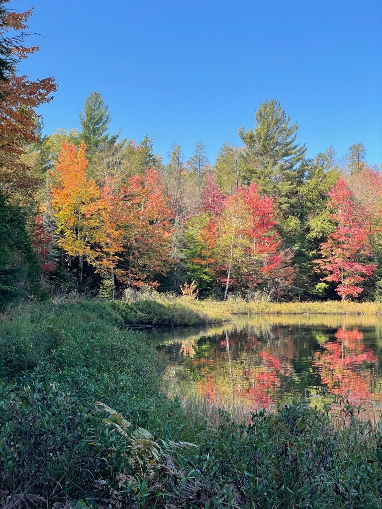
Nearing peak color in the eastern UP
We had hoped to stay in one of the nearby state or federal campgrounds, but they were all fully booked for the weekend. Such is the eastern UP during leaf peeping season. We arrived and walked around the entire island, hunting out the photograph’s spot.
Pretty, but not the spotAlso not the spotWe really hope The Boy likes this view
There were crazy amounts of people on the island for a Thursday, but we lucked out and had a few moments to ourselves at the serene spot you see above. There was even a rainbow light flare that cruised across every photo.
The Spot
And then we found it. The spot. The small stack of eroded rocks. A small section of the waterfall to the right. The very shallow pool below. The spot. We sat a while. We took a few photos. We shed a few tears and smiled and remembered.
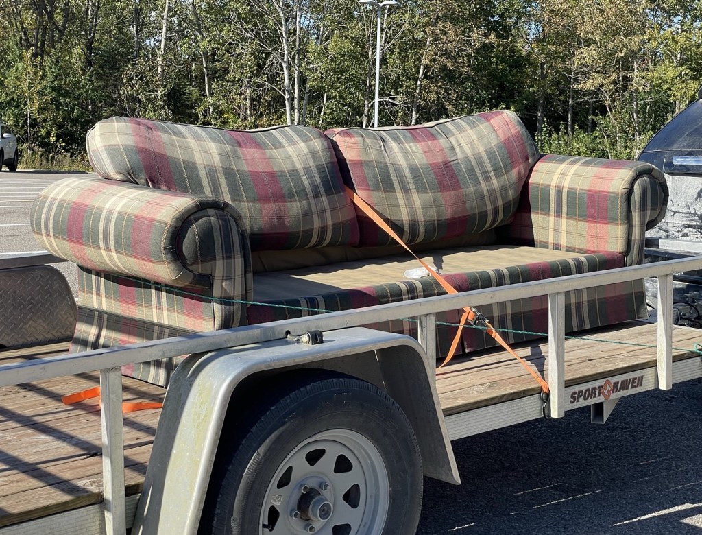
The couch
Back on the road, we realized the time and decided to stop for a quick snack. Pulling into a fast food place, we were shocked to see a couch on a flat bed trailer. To be more specific, we saw what looked like Ian’s couch, right down to its missing its feet and looking a bit faded and worse for wear. Several staff members went out to see it while we were there, as its owner was trying to find a new home for it. We got a hearty laugh out of the whole situation.
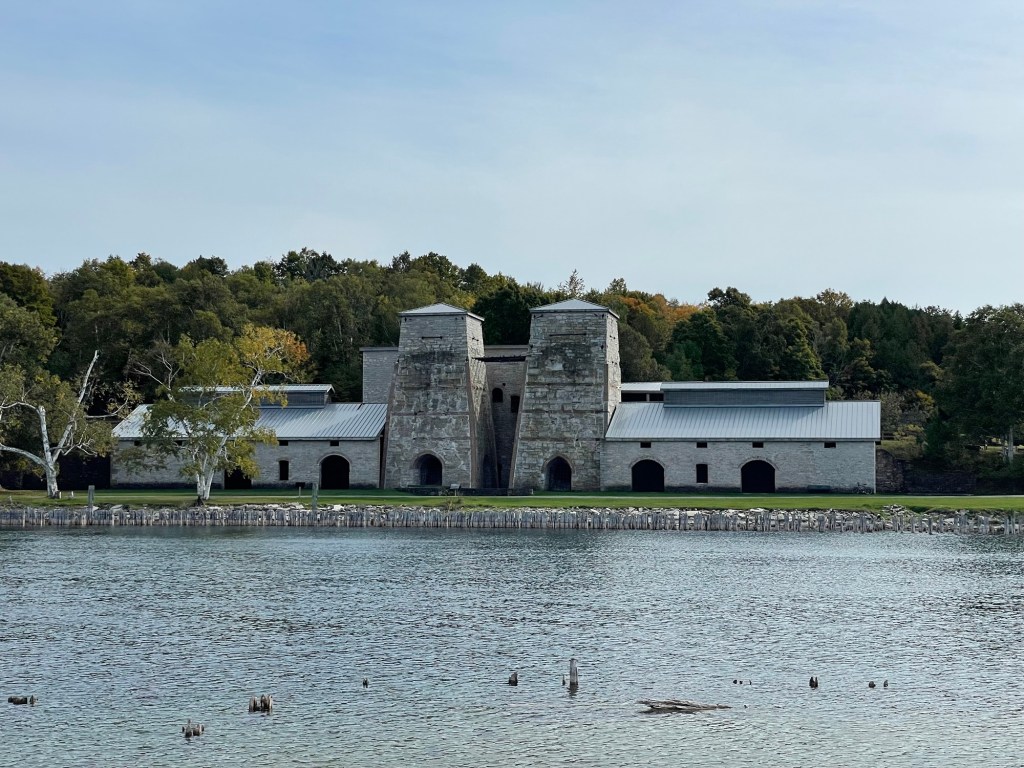
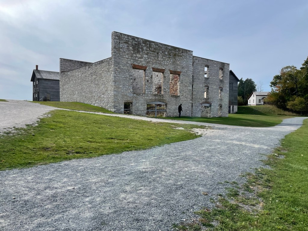
There’s no getting around the fact that Fayette — a company town on the shores of Big Bay de Noc, a peninsula on the southern shore of Michigan’s Upper Peninsula — was a major contributor to America’s Industrial Revolution and the northern states’ wealth after the Civil War. Now the Fayette State Historic Park, it’s well worth a visit if you find yourself in the area. We expected to stay an hour; we stayed most of the day.
To fast walk you through the process of making pig iron:
Iron ore was brought to Fayette and the Escanaba region on ore boats from places where it was mined, such as Michigan’s ingeniously named Ironwood, Iron Mountain, and Iron County.
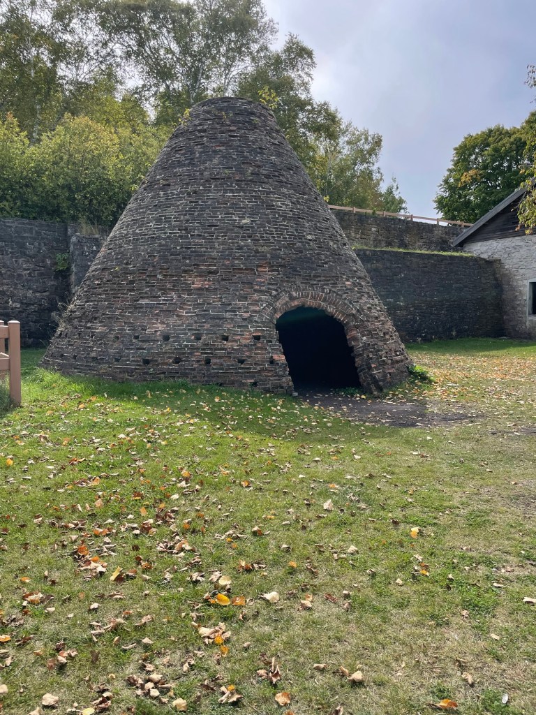
The surrounding hardwood forests were logged, floated into the harbor, and turned into charcoal in huge brick, beehive-shaped ovens.
Charcoal ovens
Flux and stone slabs were extracted from the limestone cliffs surrounding Fayette’s horseshoe-shaped Snail Shell Harbor.
Disintegrating shoreside dock pilings facing limestone cliffs
Charcoal (which burns far hotter than unprocessed wood) was used to heat the twin blast furnaces, while flux was used to refine the smelting iron ore at extremely high temperatures.
The tall central furnaces are flanked by twin smelting rooms
This liquid crude iron was poured into a series of hand-dug pits which branched off a thin central line. While hot, they were thought to resemble nursing piglets. Hence the name.
Once cooled, the pig iron ingots were loaded onto ore boats and floated to the steel mills that lined the Great Lakes.
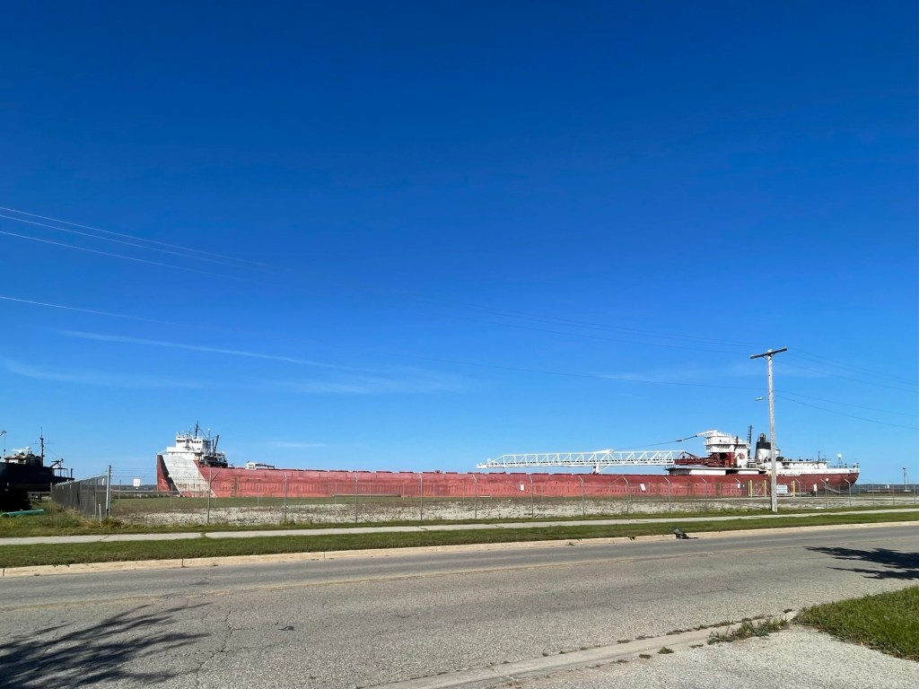
Cities like Detroit, Chicago, Toledo, Milwaukee, and Pittsburgh owe their manufacturing success to pig iron smelting towns like Fayette. Even today, large iron ore barges from Duluth, Minnesota are floated down the Great Lakes and the St. Lawrence Seaway to places far and near, as water still provides the cheapest (if not quickest) form of transportation.
Iron ore carrier, the Cason J Calloway, docked in Escanaba, Michigan
Few people today are involved in procuring or processing the raw materials that still drive our steel-dependent modern lives. After last week’s visit to Fayette, I find myself consciously thinking about the manufacturing processes and raw materials that have gone into creating the big and little things that make our current travels possible. The truck that pulls our trailer? The frame the trailer sits on? The bikes we cruise around on? The cast iron pans we cook all our meals in? Each and every one of them started with a combination of pig iron and carbon which became steel.
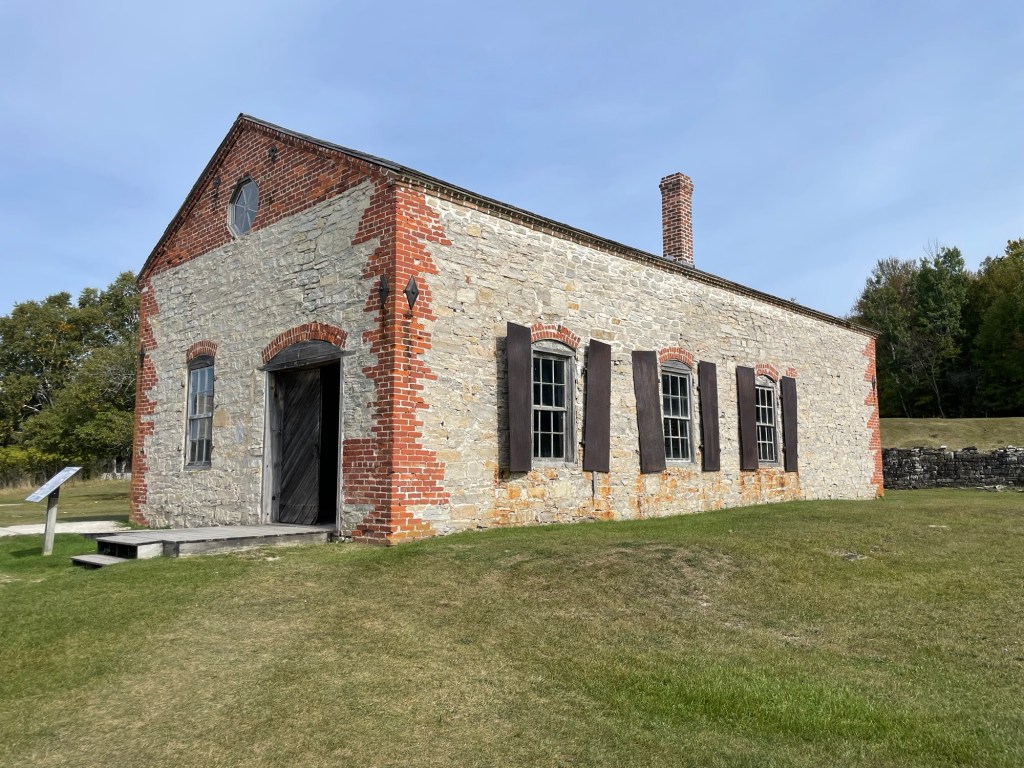
Machine shop
The machine shop was responsible for fixing anything and everything mechanical or electrical that broke or was causing the larger pig iron process to run inefficiently. Every day for these engineers was different. Every problem that arrived was a ‘needed that fix 20 minutes ago’ situation. The metal shutters and extra thick walls protected the rest of the site from explosions.
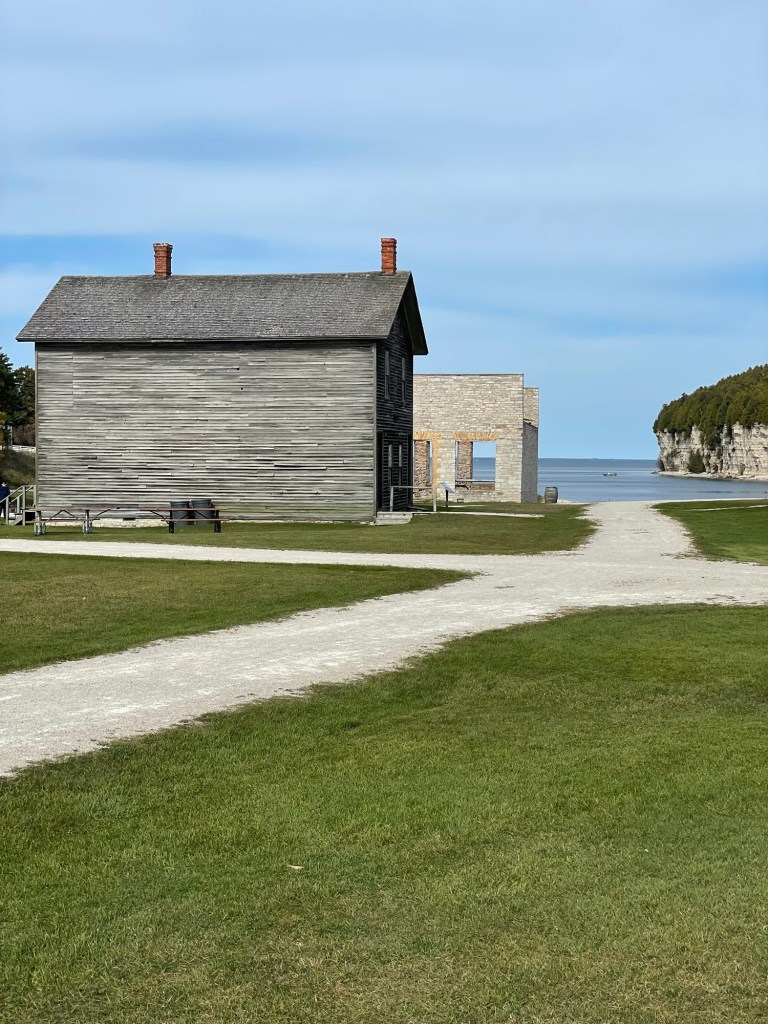
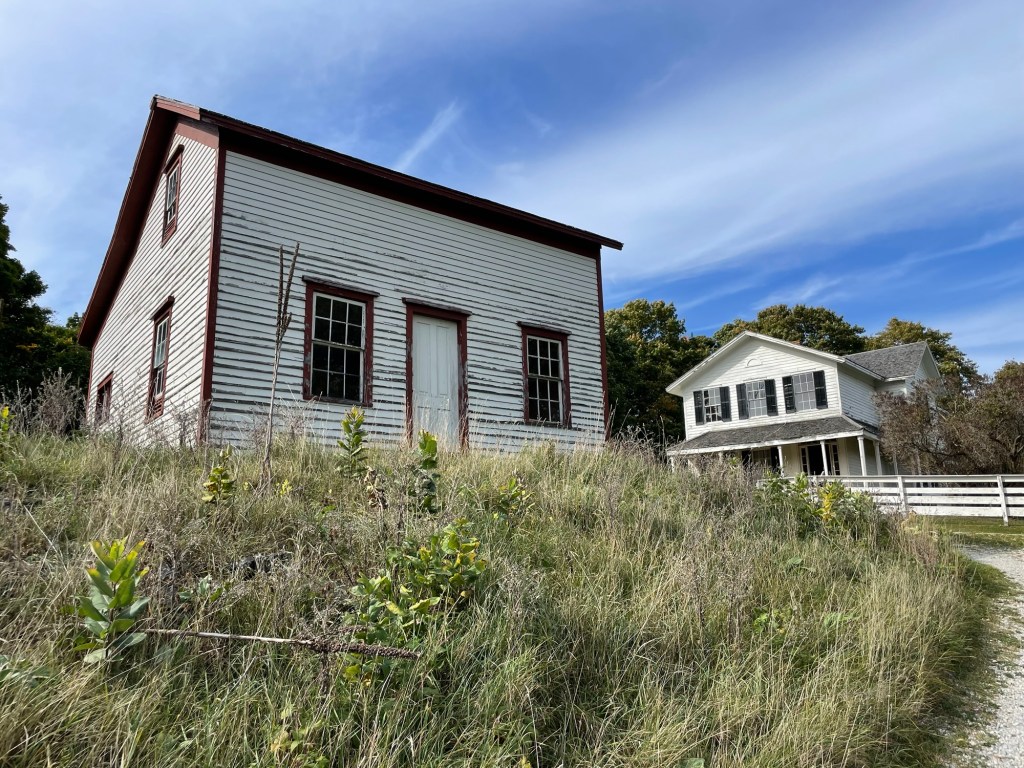
Pay master office and manager‘s office building
The men would line up each week in the above wooden building to get their pay packets from an iron-bar and safe-protected office door which was along the corridor that stretched from one of the building to the other. The Manager had his office next to the Pay master’s, and the men would pass it on their way out of the building.
Company store
Fayette was a company town, which meant that the company owed all the facilities, lodgings, and services available. Fayette was known for having fair prices and good services, which was not often the case, and was therefore a popular place to work — despite the harsh climate and hard, dirty work.
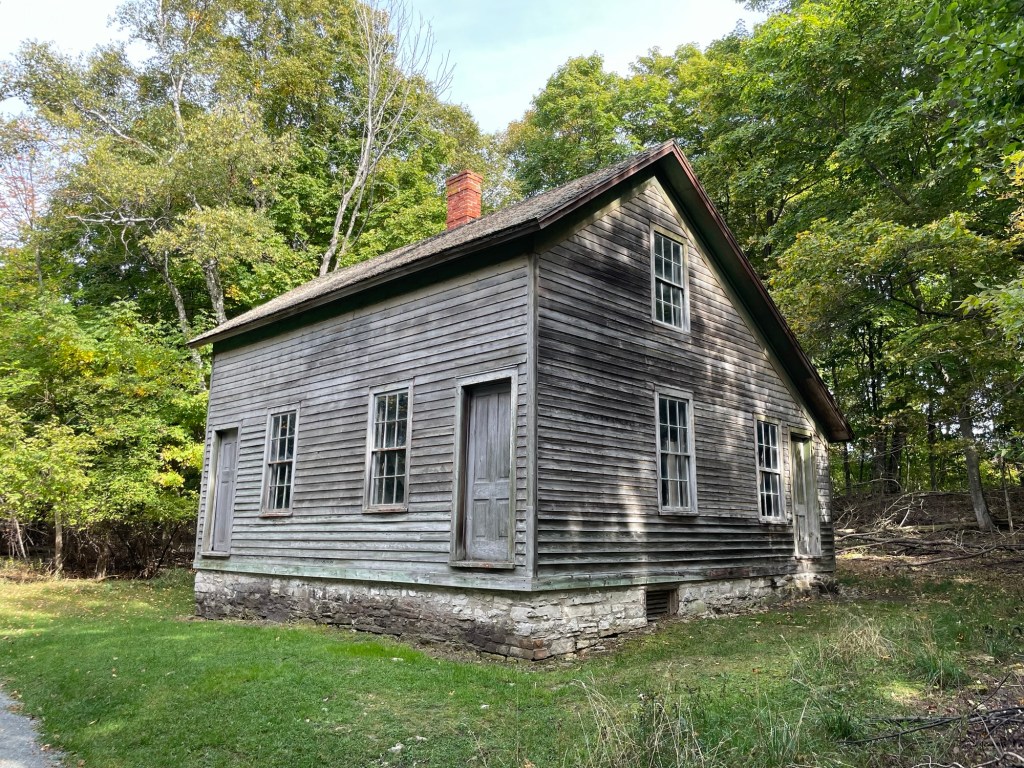
Unskilled laborer’s cottage
Entire families, with often a boarder or two, would live in a small cottage like the one above. Packed tightly one after the other, the conditions in one report were referred to as being dirty, loud, brutish, congested, blanketed in foundry smoke day and night, and disease-promoting with hordes of barefoot, filthy children intermixed with discarded bones, garbage, and animal feces.
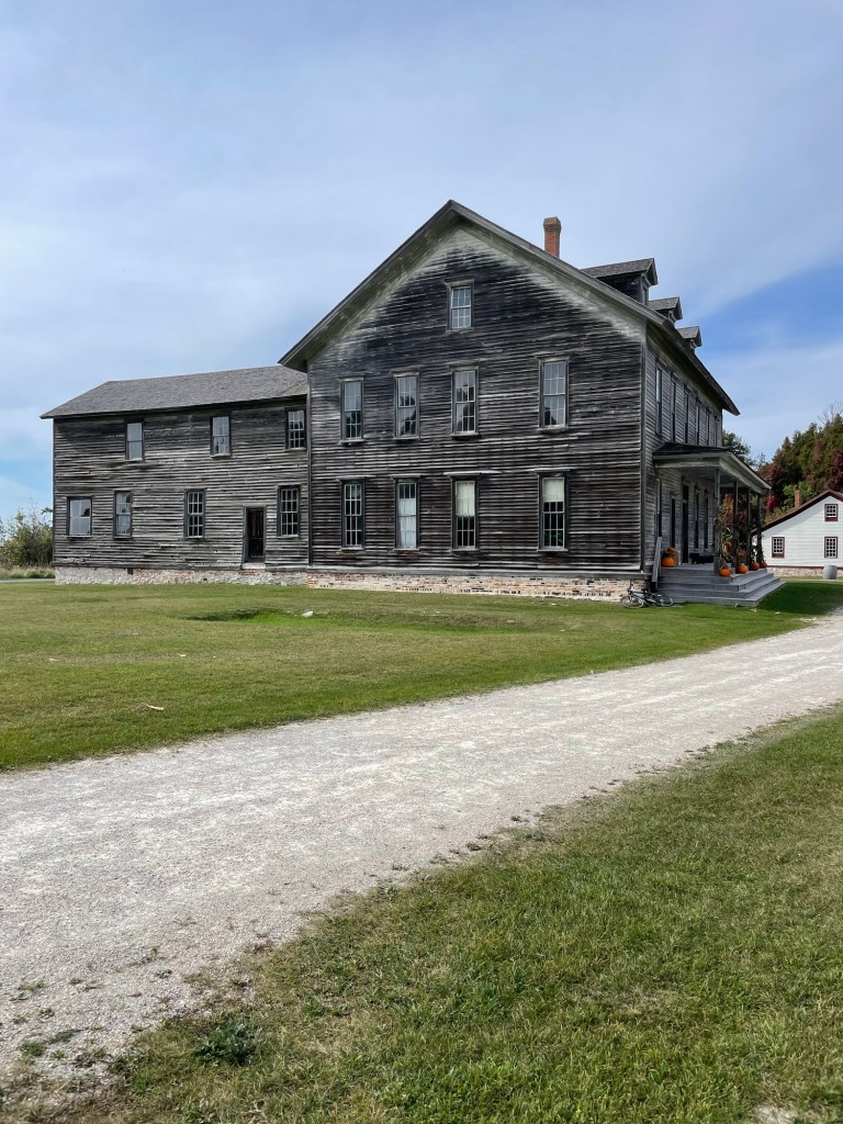
Skilled labor and middle management townhouse
The better paid employees enjoyed a more pleasant home environment, as well. Farther from the sounds and smells of the foundry, they had more personal space and cleaner living conditions. They were able to travel occasionally to Escanaba, as well, where lower prices and a larger variety of goods were available for purchases.
To the right —> The White House
The company manager lived in the largest and grandest building, dubbed The White House. From its distant, harbor-side location, he could see the entire foundry and services operation. His family and servants enjoyed the cleanest and quietest home in town.
The Fayette Hotel
This large hotel welcomed all kinds of guests and had two signature, two-story privies with covered walkways, to accommodate its winter guests in comfort and style. Even after the company town closed, the hotel continued on its own, welcoming recreation-focused guests until the Second World War.
“I thought the earth remembered me, she took me back so tenderly, arranging her dark skirts, her pockets full of lichens and seeds.” From ‘Sleeping in the Forest’ by Mary Oliver
It’s hard not to relax when a forest welcomes you with a warm, colorful embrace. Sylvania Campground on Clark Lake is a National Forest campground in Michigan’s Upper Peninsula, near the Wisconsin border. We stayed there after leaving Duluth. Hovey Lake Campground is a National Forest campground not far from the southern coast of Lake Superior. We stayed there last weekend. For the most part, National Forests campgrounds appear to be rather rustic, but Sylvania had paved parking spots and even a few sites with power. Hovey Lake, on the other hand, was definitely rustic with only four no frills campsites and a pair of pit toilets, but it was also free. And we don’t argue with free these days.
At Sylvania (campsite view, above), the colors were just beginning to turn in the campground, around the lakes, and along the hiking trails. Everything there was still mostly green, with reds, oranges, and yellows peeking out here and there. At Hovey Lake (the view from our campsite, below), autumnal color was out in force. The area isn’t at peak yet, but with the rate of change we noticed after just two nights, it will be very soon.
Something we’re getting more comfortable with as we travel is not making reservations. Because the camping season isn’t at peak anymore, we just look at which camping areas are along the way, decide which might work best for our current mood (hike, bike, fish, read, save money, sight-see, visit others, etc) and check if there’s a spot open for us. We’ve had good luck so far. If we have signal and there’s reservation info online, we’ll see how the numbers look. But if not, like for Hovey Lake, we just drove up on Friday looking for possible places to fish and hoping for an open spot. Not 15 minutes after we set up the trailer, another camper came and took the last site. Later, he told me that he’d been by the evening before and all four were full. Luck of the draw.
Jeff took his fishing gear on our hike at Sylvania and caught quite a few fish in Katherine Lake, above. I listened to an audiobook and enjoyed the soft, bouncy feel of layers of pine needles beneath my feet. Nature’s gymnastics mat.
Although he saw a few Perch* and Bass and a ton of minnows at the Hovey Lake campsite (below), they weren’t biting. At least he only had to take about 20 steps to cast a line. While wading out, he realized that the lake was quite shallow all the way across, and thus not good habitat for the larger fish that like deeper water.
I was astounded by how clear the water was and by how many large clams (mussels?) there were. Someone help a non-water gal out. They were easily as long as my hand. Something had been dining well recently, as evidenced by a messy pile of shells strewn over a small area on the opposite bank.
Something that I’ve found disturbing this week is fires being left unattended. One evening last week, while staying at a municipal campground (more on that next time), I woke up to relieve myself and found an abandoned fire pit with coals still so red hot that I could see them from our trailer without my glasses on. The local yokels who randomly pulled up around 6pm were long gone when I went to bed at 10pm. So there I was, pumping water into buckets at 1am to drown someone else’s fire because they didn’t have the good sense to do it themselves before they left.
And on Saturday, while we were hiking the Hovey Lake area, we came across smoldering logs in a fire pit, at noon. Not a soul around. I can only wonder at how long it had been burning. My only hope is it was a breakfast fire and not from the night before. We used our water bottles to drench it as best we could. It’s not like you can just turn a blind eye to something like that. What is wrong with people who behave so irresponsibly?
There are Moderate fire danger signs all over that area, for Pete’s sake. I know that the threat of wildfires is ever-present to those of us who live in the arid, mountainous west and that makes me hyper vigilant, but come on. Smokey the Bear has been having this conversation with the nation for decades.
At one point, while I sat on this log, doing nothing but being, staring across the water, Jeff walked out onto it as well and it was immediately clear that it was unlikely to hold us both for long. A yellow canoe on the opposite side of the lake (sorry, no photo) glided into and out of view. I couldn’t have ordered up a more perfect accompaniment.
“Many of these trees were my friends” — Treebeard
A few times on our five-mile, four-lake hike, we ran across trees bent over at a 90° angle. I assume it’s due to time or disease, but I can’t say for sure. They weren’t snapped off high up the trunk like the derecho-hit trees we saw in Bemidji, Minnesota. They remind me of that scene late in The Twin Towers during the last march of the Ents to destroy Isengard.
Hey, I know you
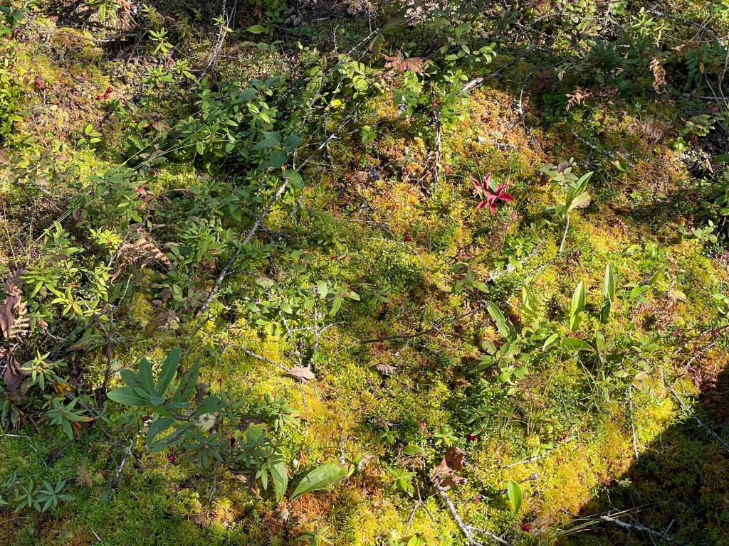
Some more Sphagnum Moss up close and personal. Isn’t it beautiful?
Clark Lake is the largest of the four Sylvania lakes we hiked to. It had a lot of wave action for such a calm day. A group of college friends must have had the same idea as us, because they kept meeting up with us at each stop. Even being so close to the Wisconsin border, we were surprised to be the only non-Wisconsin plated vehicle in the parking area. Where are all the Michiganders?
Water, trees, leaves, and a setting sun? Who needs amenities when Hovey Lake gives views like these while making dinner?
Our plain o’ public lands. I sure do love them.
Si quaeris paludem amoenam circumspice
If you seek a pleasant swamp, look about you. (Sorry, Michigan.)
*Not pike, as originally written. Someone was supposed to edit for fish and other details that I don’t know anything about but didn’t really read closely because he was chatting with friends
Back in 2018, coming off a couple years of doing triathlons together, Jessica and I decided we were going to run a full marathon. We laid out the training plan. We committed to it. We found our perfect race: Grandma’s Marathon along the Duluth waterfront. It was the right time of year, we’d heard great things about it, AND Jeff had a personal connection to the city in the form of two former coworkers.
And then I broke my arm. No more running for me, declared my cranky orthopedic surgeon, not even fast walking for the next few months. I was sidelined. The timing fell apart for Jessica. We put it off, “for a bit.” Covid came and went. My lungs took a beating. We moved away. Running fell into the ‘I really should’ instead of the ‘I want to’ state. Time rolled on.
Anyway, back to our travels.
After our unexpected detour south, we headed to Northfield, Minnesota, best known for the Northfield Bank Raid of 1876 which ended the James-Younger Gang. 1876 was a big year in Wild West history, and this was a significant event in 1876. Take a moment to read up on it. Joseph Lee Haywood is rightly considered the town hero.
That evening, we found a place to stay along the Mississippi River, just outside Red Wing, Minnesota. Yes, of Red Wing shoe fame.
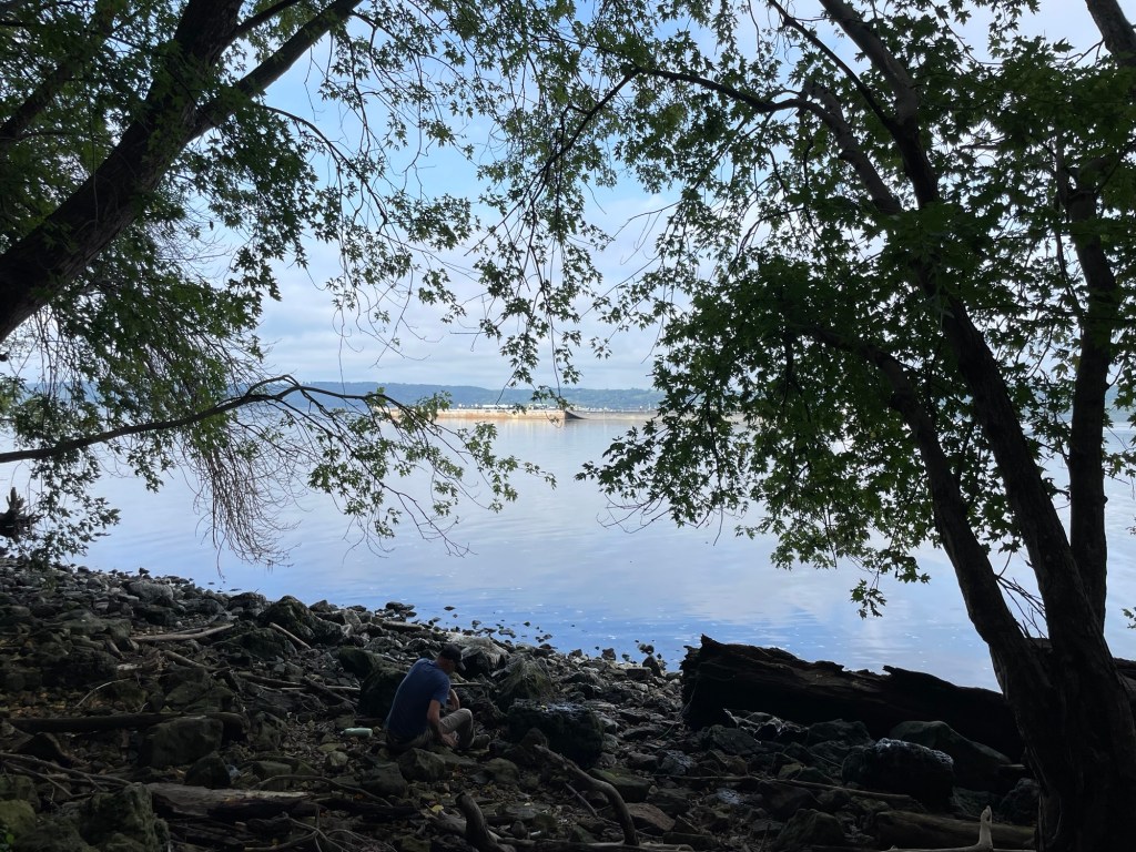
The first morning there, we took a steep, slick, rocky trail down to the waterline and caught sight of a few barges floating past. The thrum of their diesel engines over the water is very distinctive, similar to the rhythmic chugging of train wheels across tracks, but deeper and a little slower.
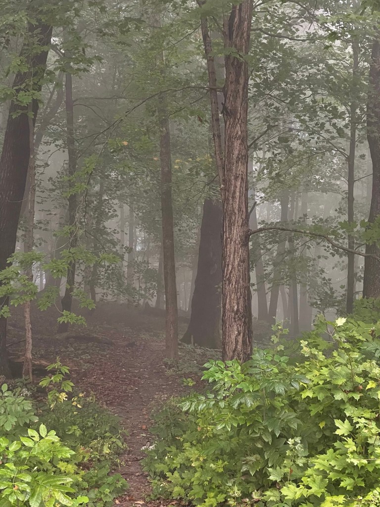
With so much humidity in the air, we woke both mornings to a spooky, spongy, foggy forest. It was beautiful and totally didn’t creep me out, despite having been forced by my older cousins and neighbors to sit through so many terrible, teenage-geared slasher films.
Post-shower towels. Wash cloths. Socks. Dishrags. A pair of hand-washed tan pants that may have unexpectedly slid across some lichen and moss-covered rocks down at the waterline. After two days of evening thunderstorms and persistent high humidity, nothing ever dried. We headed out with a rather soggy dirty clothes bag, a replacement camp stove ordered, and breakfast in our bellies.
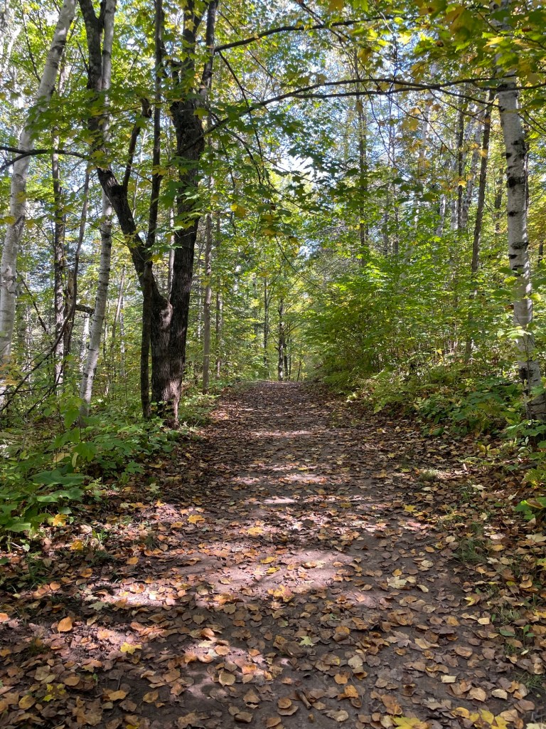
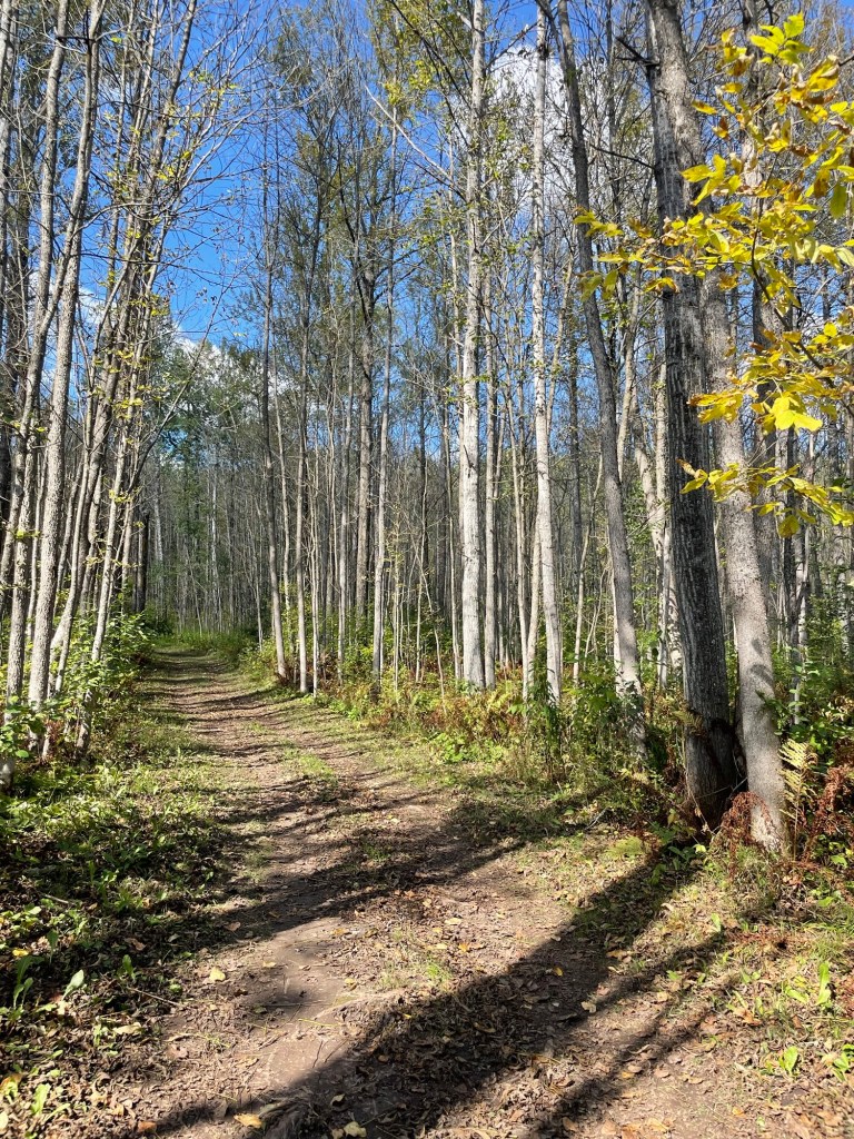
Although best known for its Swinging Bridge, we thought Jay Cooke’s forest walks were the real treasure. It didn’t hurt that it’s autumn, the colors were really starting to pop through, and the weather was soooo fine. Sunny, 70° days, and with nary a raindrop or a mosquito to be seen. A welcome change. You can almost hear the leaves crunching underfoot just by looking at this trail.
I continue to feed my morbid fascination with mushrooms that look like they’re plotting our demise. The one below is possibly a variety of Armillaria mellea, better known as Honey Mushroom. If so, the internet says they’re edible. Thank you, hard no.
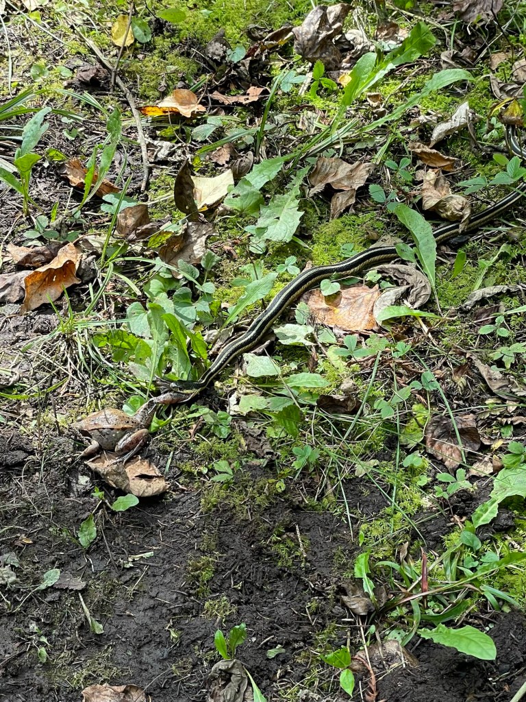
While walking, I nearly stepped on a young garter snake trying to eat a frog. It may have bitten more than it could chew, literally. The frog kept pulling itself slowly down the path while the snake tried to increase its portion of ingested frog leg. We watched for a while, but they appeared to be at a stalemate. Who gave up first?
So, back to Duluth. Yes, we finally got to visit Duluth. It only took seven years. After a nice lunch near the waterfront, we walked out to the lighthouse and watched the town’s lift bridge in action.
I would have loved to see an iron ore barge head out into Lake Superior. Alas, not to be. Many years back, we used to borrow a cottage in Canada that had ore barges float past regularly. It’s still one of my favorite memories.
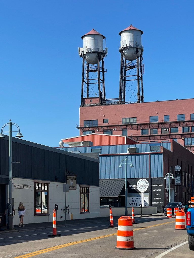
I’m not sure what these twin water towers were or are used for, but they caught my fancy.
After exploring a few places around town, completing a few overdue banking tasks, and getting some no-fridge-required groceries, we made our way over to Jeff’s former colleagues’ house. You know how some people make you feel instantly at home and like it hasn’t been 15 or so years since you last saw them? They are that kind of couple.
They went out of their way to make sure I could eat everything, even dessert! They handed us our new (delivered to their front door) camp stove. They then caught us up on their family, gave us suggestions for upcoming campsites, and didn’t wring our necks when our total lack of any time-recognition skills nowadays led us to stay far too late into their evening—and with work the next day!
You know you’re in the presence of an interesting family when you see a bike jump attached to the back of their house. Hopefully it won’t take another 15 years before we see them again.
Now, to circle back.
Our kind—and hopefully not too sleep deprived Duluth dinner host—relatively recently ran Grandma’s Marathon and Jessica is running her first full marathon at the end of October. Congrats to them both!
We’ve been to some really lovely State Parks over the years, and one of the things I value most about them is that they tend to be spots of respite from a chaotic world. Since they don’t get the press of the National Parks, they tend to be quieter overall. And without The Big List to check off, people tend to stick around a bit longer which helps them relax into their surroundings. You get people who are just overnighting on their way to somewhere else, of course, but most stay at least a few days.
Lake Bemidji State Park in north-central Minnesota was like that. Calm, quiet, friendly, relaxed. The heavy tree cover made seeing the stars difficult, but it was certainly dark enough.
NOT Lake Bemidji
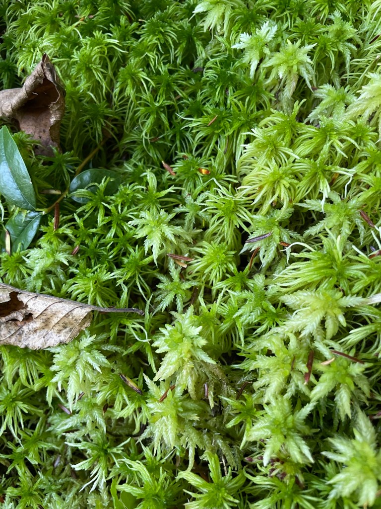
We stayed four nights, and on the first full day, we walked over to see Big Bog Lake (above). If you’re a rare plant lover, this park is for you. Unfortunately we went after the bog’s peak (mid-May-June) so we didn’t see any of the orchids or other rare and fragile bog flowers, but we did see a lot of the Sphagnum moss that holds the wet, boggy terrain together and heard a cacophony of bird call.
A informational plaque calls Sphagnum moss the bog’s carpet. It holds vast amounts of water which helps keeps the land wet and cool even in drought conditions. It was used by native peoples as diaper material, and since the acidic conditions render it effectively sterile, it was used as wound dressing in WWI.
Sphagnum moss
A massive derecho rolled through the Bemidji area in June, topping or knocking over ten thousand trees. There are still areas where the local and regional hiking and cycling trails are closed. Cycling and driving, it was clear that huge areas were absolutely gutted. Nearly every yard had wood still laying or piled up from the summer. It’ll probably take decades for the region to recover fully.
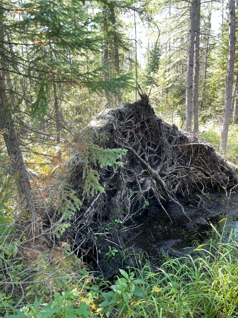
In the bog, tree roots are especially vulnerable to uprooting and we saw many uprooted and on their side like the one below. It’s so easy to forget how wide but shallow tree roots are until you see something like this.
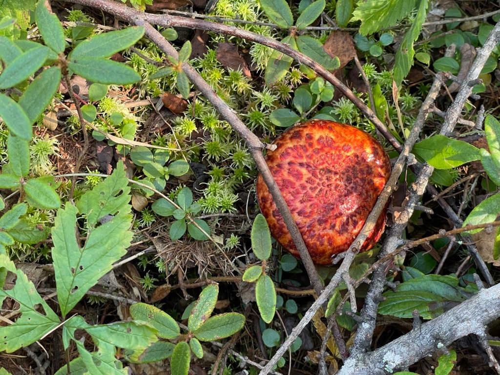
Look at this gorgeous orange mushroom. It has that, ‘I kill you; I kill you dead,’ vibe that nature does so well. I had to look it up. Come to find out, Suillus spectabilis is edible, but smells nasty/pungent and tastes sour—if you’re into that sort of push your luck and hope it’s not an imposter wild mushroom forager thing. I am not. I like very few mushrooms, but the ones I do like are sliced, pressure cooked, and in a tin can. Like god intended.
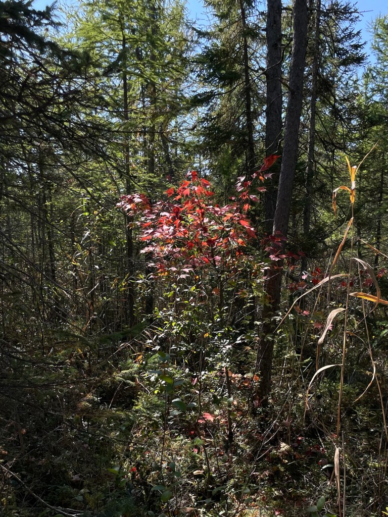
It’s been nice to see such a variety of trees in the Minnesotan forests. Nothing against high altitude forests, of course. I’m still a sucker for Ponderosa and Lodgepole Pines. But we’d kind of forgotten how pleasant it is to see punches of red and yellow and orange popping out amidst the conifers in the fall. I mean, just look at that proud little red maple showing off in the bog.
Later that same afternoon, we grabbed our bikes and rode the park’s mountain biking trails. Jeff couldn’t get over the fact that they were grass covered. While zooming down one hill, we passed some guys doing tree cleanup who had parked right in the middle of the trail. Calling out a ‘Halloooooo’ had one guy running, apologizing profusely for blocking the path. He explained that we were the first people he’d seen riding the bike trails in the two seasons he’d worked at the park. Can you imagine?! No one else is riding these pretty trails? I can’t wrap my head around it. The high mowed grass made more sense after that.
Eventually, the trails brought us down to Lake Bemidji (below). We walked along and took in the pretty reflections, laughing at the little kids shivering and splashing in the cold water on this unseasonably warm day. We found the fishing pier. Later Jeff put his new MN fishing license to good use while I heated up some leftovers for dinner.
But before heading to our campsite, we happily paid an unreasonable amount for some ice cold sodas to help us cool down. I fixed my bike’s brake pads at the bike repair station. While doing so, a stranger came running up with my phone. Oh my heart! Thank you, thank you, kind sir. It must have fallen out of my pocket right after stopping to take the following photo. Sheesh. I have a bright red cover for a reason.
This IS Lake Bemidji
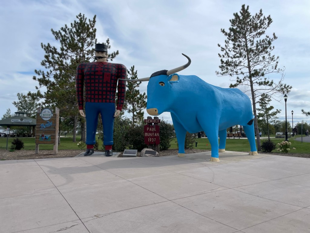
The next day was significantly cooler, so we rode our bikes around Lake Bemidji, visited the Paul Bunyan and Babe the Big Blue Ox statues (a massive highlight for me tbh), and had lunch in town. Bemidji is a nice little town. I hear the winters are pretty intense, but we can vouch for an autumn visit. Folks were friendly, the town had all the necessary conveniences, and the rounded upper Midwest accent reminded us of Jeff’s years in Michigan’s Upper Peninsula.
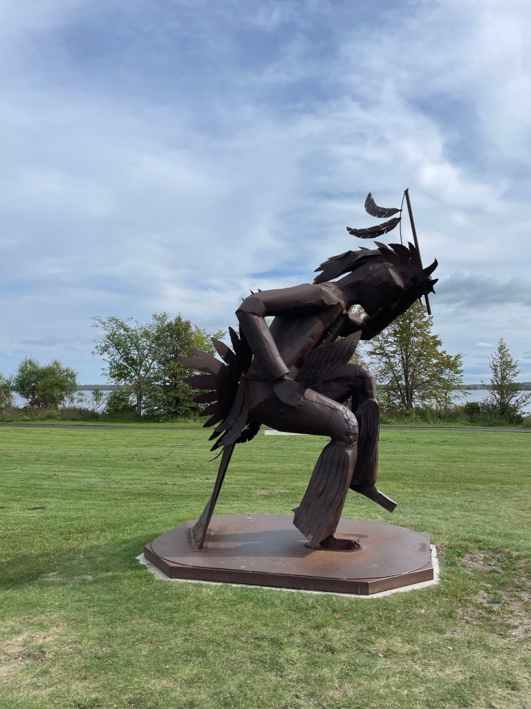
I love the energy in this rendition of Chief Bemidji, although there is another one further north along the lake that is more detailed and accurate.
Over lunch, we discussed options. With some storms coming in, we debated whether we should go east to outrun them, hunker down here for the weekend, or go north to International Falls as we’d planned.
So that’s the relaxed.
As for the rushed, once back to the trailer, Jeff got a text message letting him know that a former colleague with some serious, ongoing medical issues had moved to Hospice Care. We locked eyes and made the decision that we were changing plans and heading south in the morning so that he could see him again. Luckily we were only a day’s drive away, so we packed up that night and headed out first thing in the morning.
We started with heavy fog and experienced a lot of the travel terribles: downpours, lightning and thunder, heavy wind, major road construction, and the horror that is the Minneapolis-St Paul driver. Denver has a strong competitor in the lousy driver category.
But Jeff got his visit yesterday, and I did the usual weekend cleaning and reset tasks while impromptu cat sitting. Worth the detour.
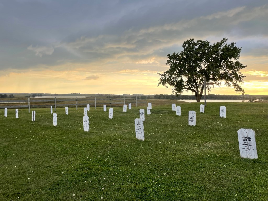
There’s an app for that! Ok, the Fort Sisseton Historic State Park app is a bit out of date for current events (hello, two years?) but the audio guides are useful and full of interesting information. I especially enjoyed the selected readings from Captain Bennett’s and Sergeant Andrew Fisk’s writings.
A quote that has stuck with me for a few days is about a young soldier traveling to the Fort in a terrible December snow storm. Several days after he was supposed to arrive, they found him sitting along the road with his back to a pole, unable to move. After a few days in the Fort’s hospital, Sgt. Fisk wrote in his journal, “Ben Franklin, whom I know, was frozen so badly that he will lose both legs and both arms.”
Of all the places I wouldn’t have wanted to be in the mid-1800s, the Dakota Territory as an enlisted soldier would be high on the list. The miserable conditions, the harsh climate, and (from every source) the unrelenting boredom is beyond what those of us living today can probably even imagine.
But then again, there were horses. Horses everywhere.
For each of the Fort’s buildings, a plaque at the front has a quote from one of the men’s writings. For instance, in front of the stables, above, Sgt. Fisk noted that his horse had slipped on the lake’s ice while being watered and fell through and the poor beast nearly died of exposure before Fisk could get it back to camp and warmed up. What a struggle these people and animals went through for basic living needs.
A stable like the one above was my idea of perfection and my greatest wish growing up. It still makes my heart beat a little faster and it put a huge smile on my face as we drove in on Saturday. What a beauty. Nowadays, it’s the main bathroom and shower building for the park and campgrounds.
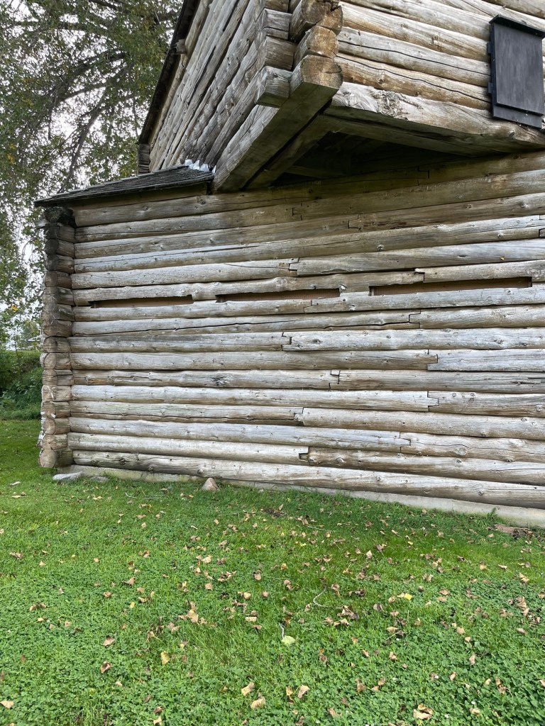
Many of the buildings at Fort Sisseton Historic State Park are partial reconstructions, like the security blockhouse below. The Works Project Administration did the bulk of the restoration (including corrective rebuilding) in the 1930s.
Just a side note, but it amazes me how much of our current National and State Park architecture, historical documentation, and public art — nationwide — was done during that period by the CCC and WPA. It amazes me even more that some people now think those were bad programs. They literally kept entire extended families from starvation while simultaneously creating our greatest public recreation and educational facilities — ones that are still in daily use nearly 100 years later.
The way these logs are notched together is mind blowing.
You can see the side of the hospital (above) to the left of the blockhouse and (below) the front of it. Poor Ben Franklin. I wish I knew what became of him after all his limbs were amputated. Did he survive the surgeries? Did he want to? Was he shipped home? If so, who took care of him and how did he spend his remaining days? I have so many questions.
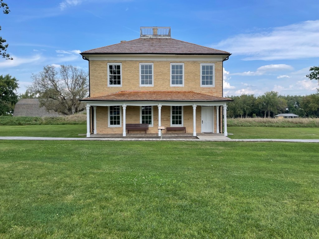
After the first two years, when the enlisted men were housed in tents — on the prairie, in the upper Great Plains, in winter, I can’t even imagine — Fort Sisseton finally constructed two bunkhouses (the South Barracks is shown below) for them. That is, after the Captain’s house, the Officers’ quarters, the Surgeon’s house, the Hospital, the Guardhouse (jail), and etc had all been built. Yes, I’m feeling a little bitter about it on behalf of poor Sgt. Fisk.
The Adjutant’s Office and Quarters (below) is my idea of the perfect little stone cottage. And since it matches my dream barn so perfectly, I call dibs. This one is mine. The central wood stove will keep it toasty.
The Powder Magazine is a strangely ornate, half-stone, half-brick, step-gabled building that was much, much closer to the residences, offices, and guardhouse than I would have expected or appreciated, being highly explosive and lethal and all, but what do I know? Front and rear views below. Yellow building between them is the Guardhouse.
The officer’s quarters (below, left) also housed the officer’s families and servants. The Captain had a two story home (but was forced to share it with some unmarried officers due to a housing shortage), and the Surgeon and his family had a small bungalow to themselves.
Despite such luxurious digs, the frontier was still the frontier and it was still a rough place to live. The Captain’s house was so overrun by bedbugs, for example, that he eventually sent his family, servants, and furniture away while they tried to eradicate the pests.
I want to know what this cute little cart on the Surgeon’s porch was for. I think it was made to be pushed by a person versus dragged by a mule, but I can’t quite figure out what purpose it served. What do you think?
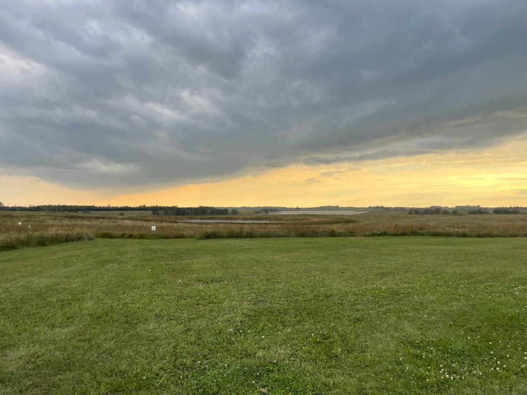
As Sunday afternoon wore on, we watched the clouds gather and got a bit concerned. The weather folks were talking of a strong storm in our area and the rising winds made that talk feel really likely, so we drove into the nearest little one horse town for dinner.
Technically there was one horse and two ponies. The food was decent, the welcome not so friendly. Apparently South Dakota does not participate in Midwest Nice.
The rain never materialized.
But man oh man, what great clouds. I mean, look at those things. You can hear the opening to Twister just by looking at it. But luckily the storm went around us on two sides. All the gorgeous skies, none of the wanton destruction.
After dinner we took showers, watched the fading light, and climbed into bed. The mosquitoes and bugs had gone into hiding with the weather, so we could enjoy being out in the golden light without being covered in bug spray for a change. Glorious.
I was happy to see that the bathhouse and all four mini cabins had accessible ramps and one even had a raised fire pit. It takes so little extra effort to include more people in recreational spaces. Well done, Fort Sisseton.
On Monday, we found that the Fort Sisseton app’s 3D tours came in handy after the fact, too. Since the park isn’t open on the weekends during the off season, we did our own little walking tour, read all the plaques, and listened to the audio tours on Sunday.
The Visitor Center was supposed to open at 10am on Monday, which would have given us a just enough time to see the insides of the buildings that we’d peeked into over the weekend, but alas, no one had arrived by 11am to open things up so we left.
All in all, we were rather surprised by the unwelcoming attitude of the locals and the other campers in NE SD, but we quite enjoyed Fort Sisseton HSP itself, the history it’s trying to preserve, and the landscape it’s set in. I’m glad we stopped there.
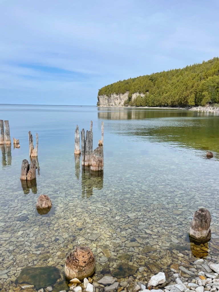
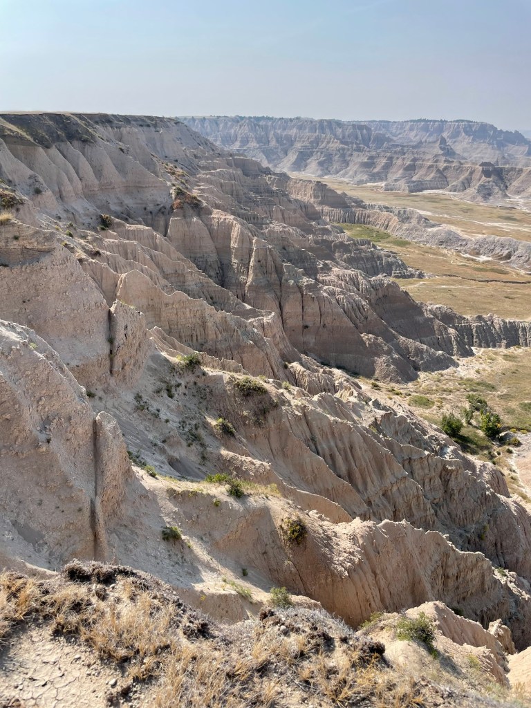
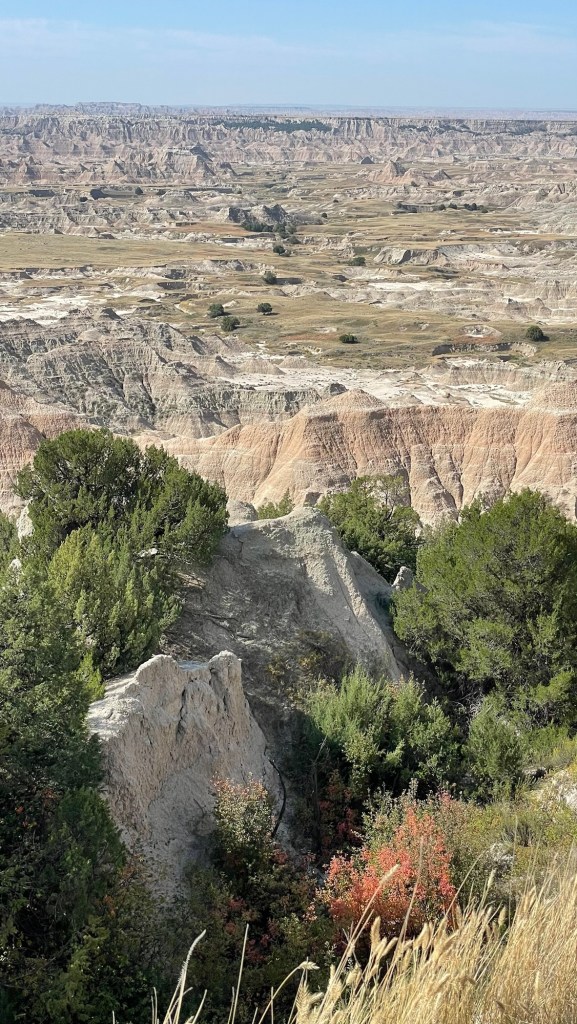
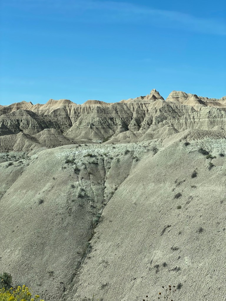
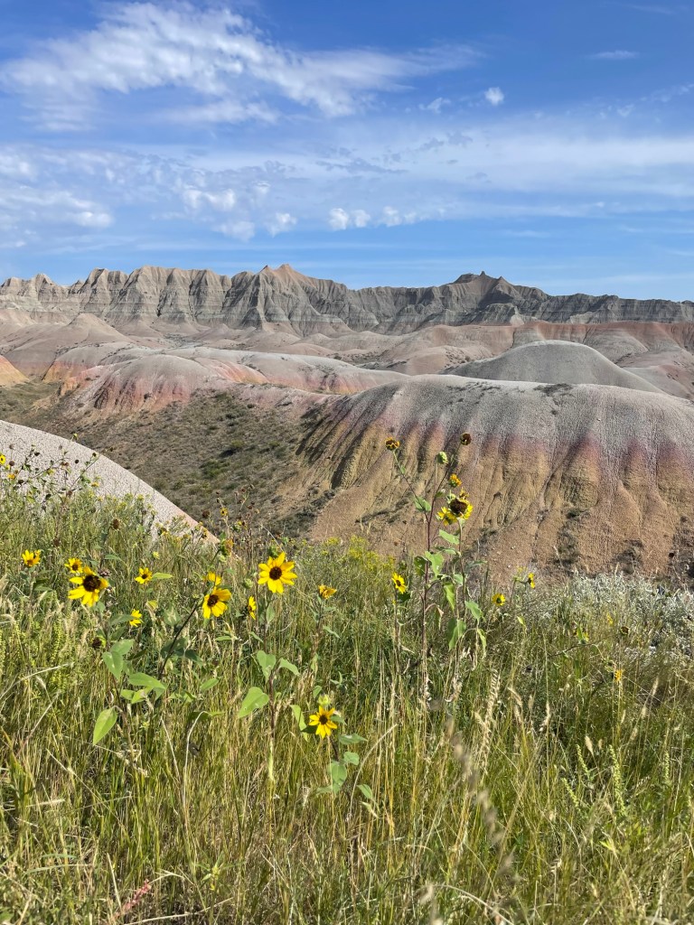
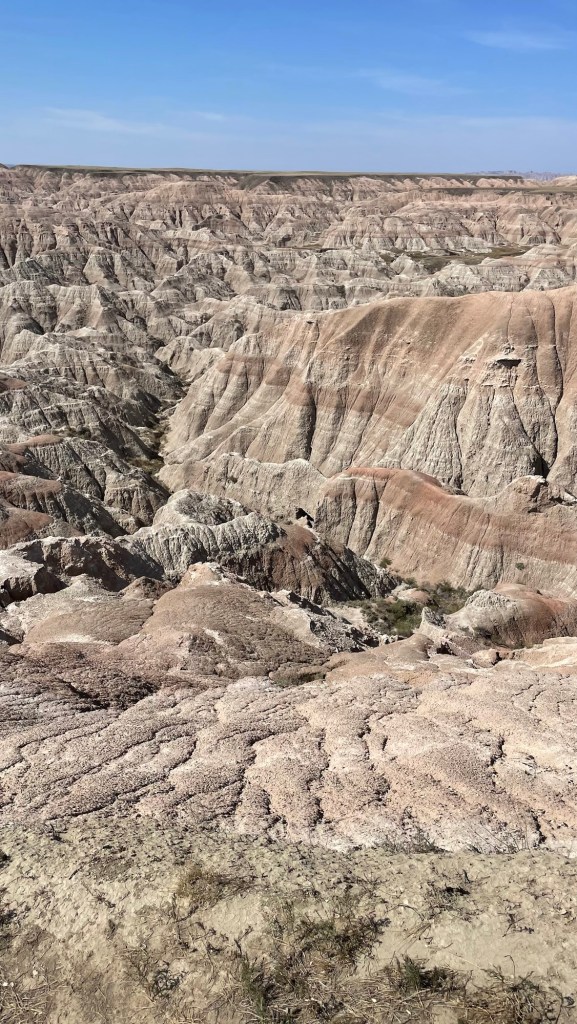
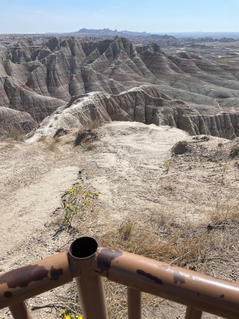
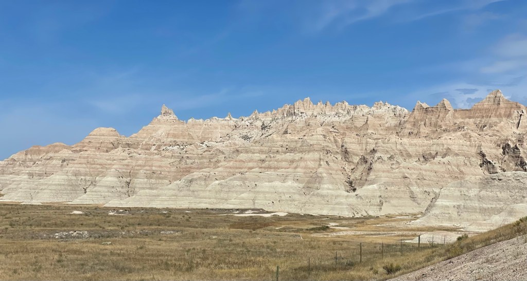
The terrain in Badlands National Park speaks for itself, so I’m going to just post some photos and keep the commentary to a minimum.
Phone viewing tip: turn your screen brightness all the way up, set True Tone on (iPhones only?), and turn night shift off. It will make a big difference here.
Don’t walk outside the barriers please.
We want to come back when it isn’t sunny and 90° out, so we just did a quick dodge in and out at some of the viewing station’s bigger parking lots since we had the trailer in tow. Not bad for a few quick point-and-clicks, eh? We’re looking forward to actually slowing down to really look at things and walking the hiking trails next time around.
If you visit, make sure to stop in at the eastern (main) Visitor Center. They have great displays, a working fossil research area, and an interesting introduction video. It’s located by the modern campground and lodge. The southern visitor center (open seasonally) takes some effort to reach, but it is also well worth a stop, even if it’s quite small. The focus here is on the history of the Lakota people and their ties to the land.
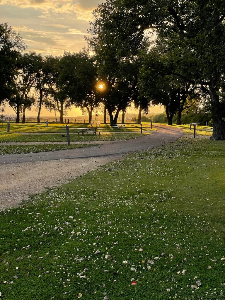
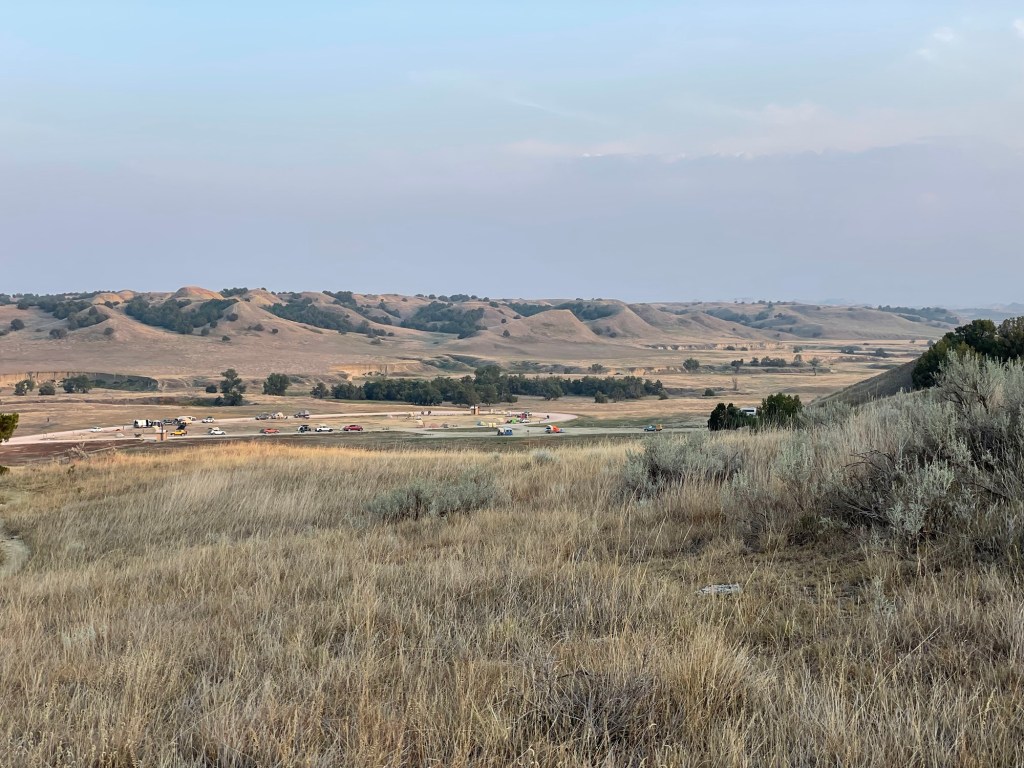
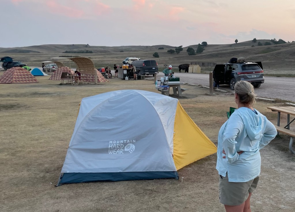
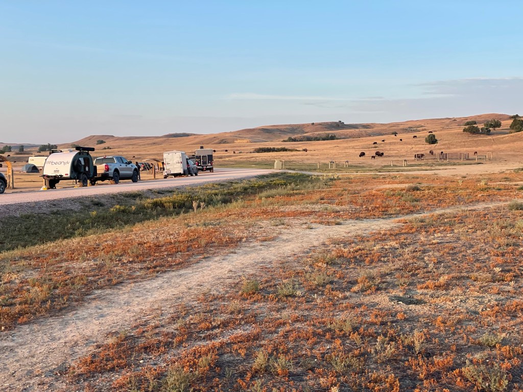
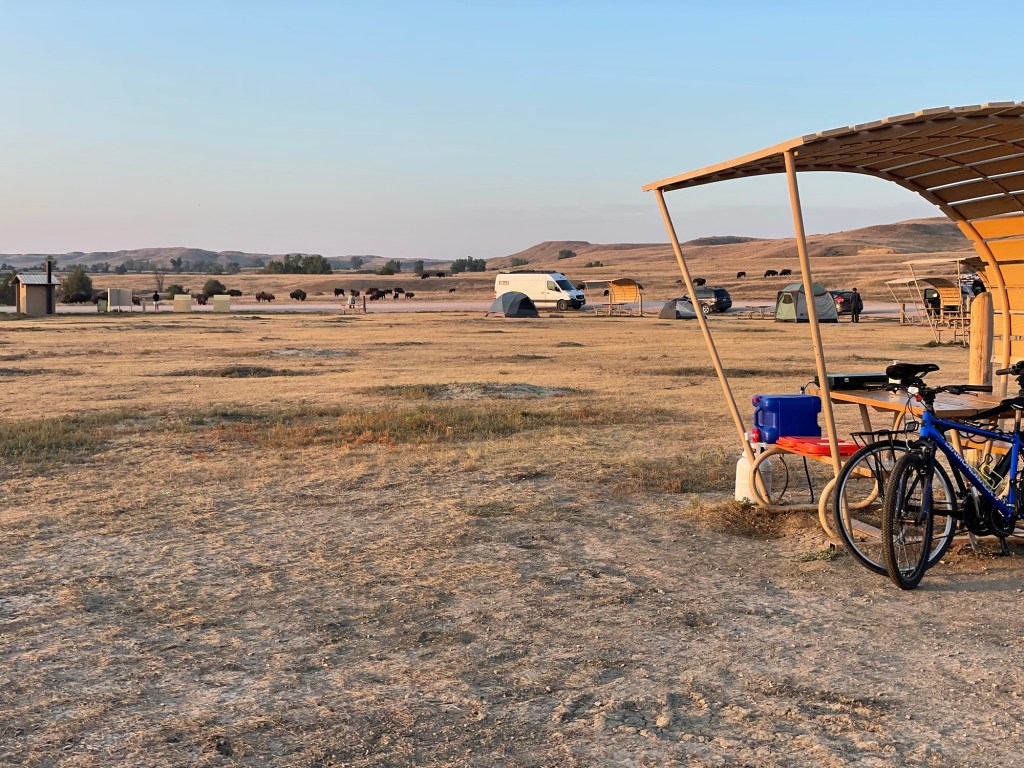
After leaving Deadwood, we decided to head east instead of sticking around for the night. I saw that Badlands National Park had a free dry campground on the north portion of the park, so we decided to give a it go. It wasn’t quite boondocking as there were vault toilets, formal parking spots, and picnic tables, but without power and water, it was still pretty rustic. We got in toward the end of the afternoon and only had a few spots to choose from. We put almost all of our leveling blocks to good use, unhitched, got settled in, and made some dinner. I read that Sage Creek Campground usually only has a spot or two left most nights, and that was true for the two nights we were there.
We couldn’t beat the price, but what we didn’t count into our calculation was the dust. The Badlands have such interesting formations because the land is being worn away by wind and water at the rate of about an inch a year, and all that material has to go somewhere. Well, by the time we left, the truck and Beangle were both a uniform grey color. A super fine dust was in the bed of the truck and even inside the bins inside the bed of the truck. I figure we took approximately a year’s worth of erosion with us as we drove away. Oh well, let’s just call the cleanup at the next campsite a part of the price we paid.
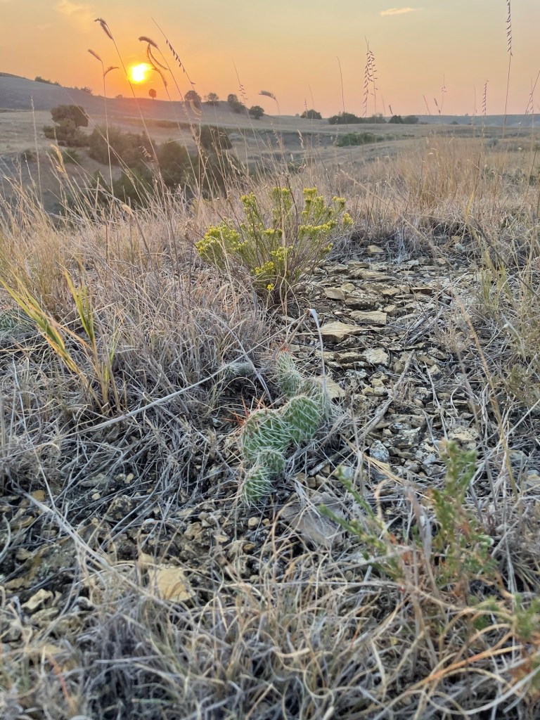
After the first night’s dinner, we climbed the rise to the west of us to enjoy the sunset and get an overview of the area. If you zoom in, you can see the trailer and truck.
Jeff’s took a really pretty sunset photo
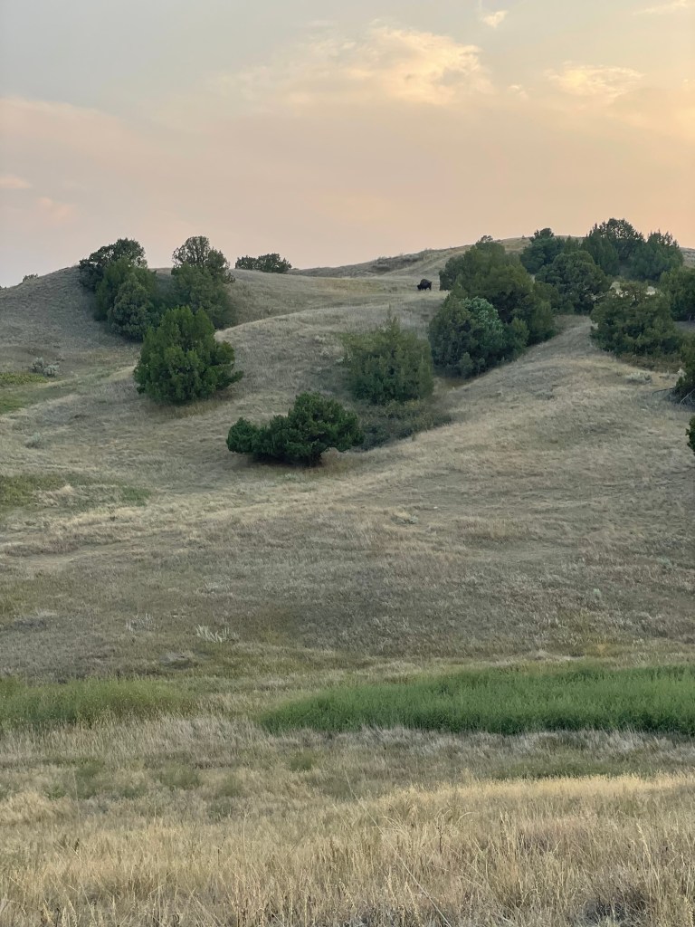
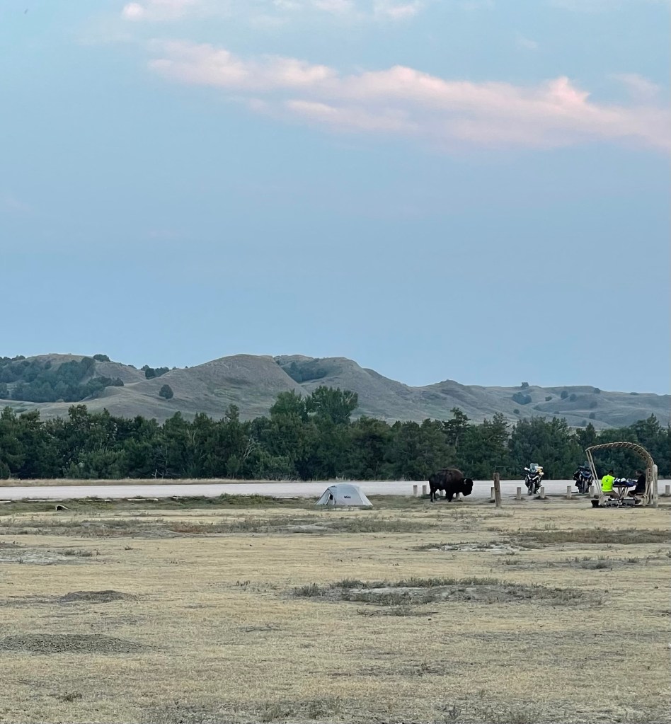
On the way back down we saw a bison munching above the campground. How cool is that?
Pretty cool. But definitely not as surprising as the bison that got a little extra friendly with some of the conveniently placed (and height’ed) posts next to some guys’ tents and motorcycles. It then proceeded to roam through the southern end of the campground. That big guy stopped right next to their picnic table, looked them dead in the face, and then kept on moving. They could have reached through the sun slats and touched him.
The next morning, when it came by for a second tryst and wouldn’t walk away from where their bikes were parked for over an hour, one of the men admitted that he’d been scared out of his mind the whole time. They’d acted so calm, you’d never have known!
The woman, below, was fun to talk with. We were cracking jokes the whole time. She might have been rethinking her tent choice, though. “I just bought that,” she called over to the bison.
The three red tents, below on the upper left, were a homeschooling family with 4 or 5 young kids. They got an unscheduled biology lesson. The dude making dinner didn’t even stop grilling. Ho hum. Bison in the hood.
On our second morning, we woke to an entire herd of mammas and babies grazing next to camp. That was quite a sight in the early dawn sunlight. By the time we were ready to pack up, they were nowhere to be seen. It’s shocking the way such a large number of animals can seem to just ‘disappear’ amongst the rolling hills out there. Top ten event so far.
Long a fan of Wild West history, Jeff has been wanting to go to Deadwood, South Dakota, for ages, so it only made sense that it be our first true destination. After leaving Wind Cave on Monday, we headed north and grabbed breakfast in the town of Custer after a brief moment of terror where I thought I’d left my wallet the day before in the Wind Cave Visitor Center.
We passed a few single-lane construction areas on the way to Deadwood, where we had to wait for the flag person and the lead vehicle. At the first one, we had to catch the flag person’s attention as he was distracted by his phone. Thankfully Jeff was pretty sure we weren’t supposed to be driving through, so he saved us all from trouble. Construction techniques and materials were evaluated along the way and found wanting in a few places. You can remove the engineer from his desk, but he’s still an engineer.
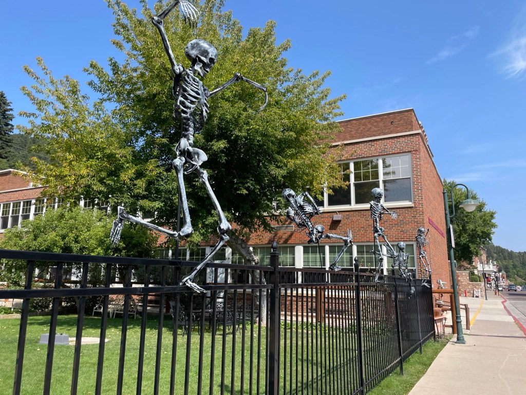
After parallel parking the truck and trailer suspiciously easily near the Old Town district, we were greeted by a wall of skeletons on this fence. Sure, why not. I’m game.
Unsurprisingly, the wood-framed shacks of the Wild West mining era (1876) burned down shortly after the town was officially formed, so we didn’t expect to see them. Nowadays it has some interesting turn of the century buildings, made from brick and locally quarried stone.
Ok, so what is Deadwood like today?
Take a 1900s era Main Street movie set and fill it with slot machines and kitschy souvenir shops. Next, slap an old timey name or a reference to Wild Bill onto everything standing. Then, charge a fee for anything history-related, such as $10 to walk into the room where Wild Bill Hickok was shot dead playing poker (not joking) or $4 to enter the city cemetery where he and Calamity Jane are buried (again, not joking) and you have the modern tourist-trap that is Deadwood.
Can you imagine wanting to visit your mom’s grave or granddad’s final resting spot and having to pay $4 — cash only! — to do so? I sure hope there’s some local workaround because that’s just appalling.
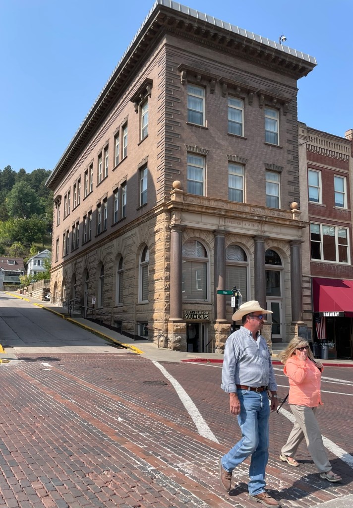
The road used to be 15ft lower, hence the odd way it meets the former bank building here.
Now run an endless parade of converted school busses between all points, blaring a canned audio tour the whole time. How-dee, Calamity! This here hooch is got a wicked kick!
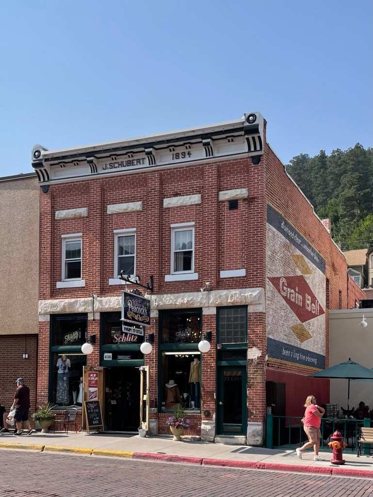
Miss Peacock’s clothing store with a Schlitz beer sign above the door ???
We could have skipped the town, and maybe we should have, but part of the trip is seeing places and finding out what they’re like. Now we know. Deadwood isn’t a do-over for us.
That said, the post office was beautiful and reminded me a lot of the one in Boise. My guess is they’re from the same time period.
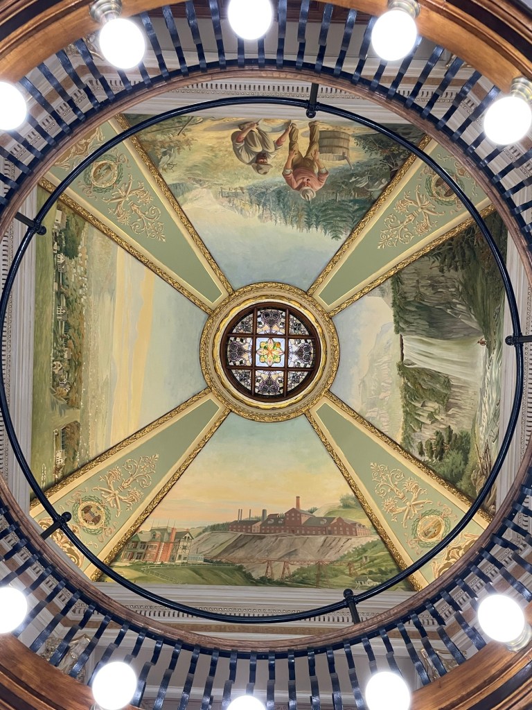
The courthouse has a lovely ceiling mural.
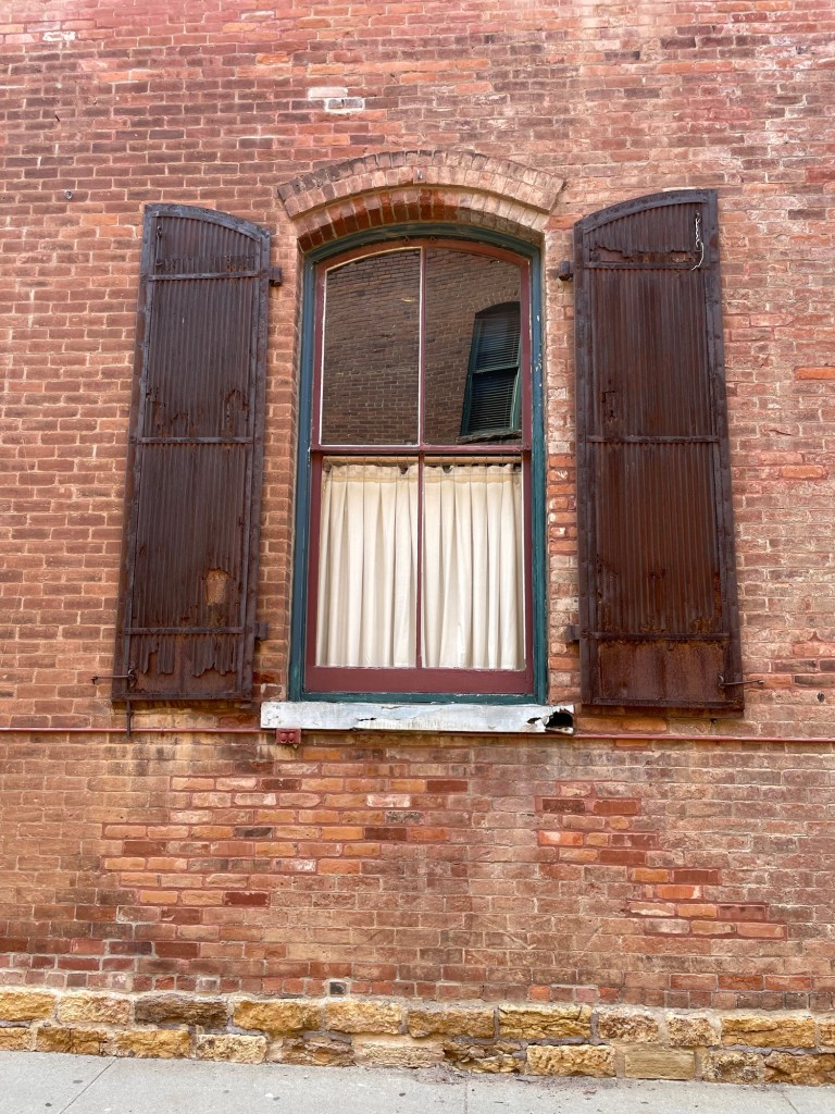
This restaurant’s metal shutters were fantastic.
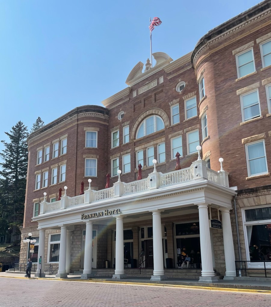
And there’s something quite grand about this hotel’s curved brick facade.
We were going to overnight in the National Forest just outside of town but chose to head out immediately since we still had lots of daylight left.